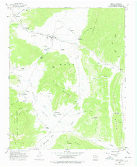
1965 Map of Mora
USGS Topo · Published 1978About this map
The Mora River valley serves as the primary corridor for settlement in this part of northern New Mexico, where the village of Mora sits at the confluence of several mountain drainages. The landscape is defined by its deep cultural roots, evidenced by a high density of religious and funerary sites including St Gertrude Cem, St Vrain Cem, and the St James Chapel. These sites are concentrated along the fertile valley floor, while the surrounding El Oro Mountains and Romero Hills rise sharply, limiting the expansion of communities like Cleveland and Cordillera.
Find a feature on this map
65 named features on this map. Tap any name to fly to it.
Don’t see what you’re looking for? This feature index may not catch every label — zoom into the map to look around manually.
Map Details
Editions of this 1965 Mora Map
2 editions found
Other maps of this area

1889 · Las Vegas
USGS Topo · 1:125,000

1891 · Las Vegas
USGS Topo · 1:125,000

1893 · Las Vegas
USGS Topo · 1:125,000

1954 · Santa Fe
USGS Topo · 1:250,000

1954 · Raton
USGS Topo · 1:250,000

1958 · Raton
USGS Topo · 1:250,000

1958 · Santa Fe
USGS Topo · 1:250,000

1963 · Lake Isabel
USGS Topo · 1:24,000

1963 · Rainsville
USGS Topo · 1:24,000
1965 · Rociada
USGS Topo · 1:24,000