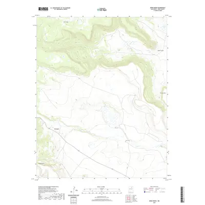
2020 Map of Mora Ranch
USGS Topo · Published 2020About this map
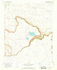
Naranjos and the Mora Ranch occupy the lowlands of the Mora County high plains, where the Ocate Cr drainage winds through a landscape of prominent mesas. This 2020 survey illustrates a sparsely settled ranching region defined by dramatic vertical relief, including the expansive Rivera Mesa to the north and Encinosa Mesa to the southwest. The presence of the Calhoun Cem near the creek provides a specific point of interest for family historians tracing local lineages in this part of northern New Mexico. To the east, the terrain rises sharply toward Charette Mesa, while the northern portion of the quadrangle is marked by Laguna Yeso and the winding Aguaje Canyon. The road network is dominated by New Mexico Route 120, which serves as the primary artery connecting these isolated rural outposts.
Find a feature on this map
14 named features on this map. Tap any name to fly to it.
Don’t see what you’re looking for? This feature index may not catch every label — zoom into the map to look around manually.
Map Details
Editions of this 2020 Mora Ranch Map
This is the sole edition of this map. No revisions or reprints were ever made.
Other maps of this area

1954 · Raton
USGS Topo · 1:250,000

1956 · Tooth Of Time
USGS Topo · 1:62,500

1956 · Miami
USGS Topo · 1:62,500

1958 · Raton
USGS Topo · 1:250,000
1966 · Ojo Feliz
USGS Topo · 1:24,000

1966 · Mora Ranch
USGS Topo · 1:24,000
1966 · Cerro Negro
USGS Topo · 1:24,000

1966 · Ocate
USGS Topo · 1:24,000
1966 · La Chata Crater
USGS Topo · 1:24,000
1966 · Charette Lake
USGS Topo · 1:24,000