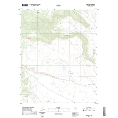
2023 Map of Mora Ranch
USGS Topo · Published 2023About this map
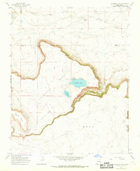
Ocate Creek flows through the heart of this high-elevation landscape, defining the transition between several prominent mesas. The settlement at Naranjos and the namesake Mora Ranch serve as primary points of human activity in an area otherwise characterized by significant topographical shifts. To the north, Rivera Mesa and Aguaje Canyon mark the rugged descent of the terrain, while Encinosa Mesa anchors the southwest. This U.S. Geological Survey representation reflects the modern rural infrastructure of Mora County, detailing the local roads and boundaries that connect these isolated homesteads. Genealogists and local historians can find the Calhoun Cem situated east of the ranch, providing a specific point of reference for families rooted in this part of New Mexico.
Find a feature on this map
12 named features on this map. Tap any name to fly to it.
Don’t see what you’re looking for? This feature index may not catch every label — zoom into the map to look around manually.
Map Details
Editions of this 2023 Mora Ranch Map
This is the sole edition of this map. No revisions or reprints were ever made.
Other maps of this area

1954 · Raton
USGS Topo · 1:250,000

1956 · Tooth Of Time
USGS Topo · 1:62,500

1956 · Miami
USGS Topo · 1:62,500

1958 · Raton
USGS Topo · 1:250,000
1966 · Ojo Feliz
USGS Topo · 1:24,000

1966 · Mora Ranch
USGS Topo · 1:24,000
1966 · Cerro Negro
USGS Topo · 1:24,000

1966 · Ocate
USGS Topo · 1:24,000
1966 · La Chata Crater
USGS Topo · 1:24,000
1966 · Charette Lake
USGS Topo · 1:24,000