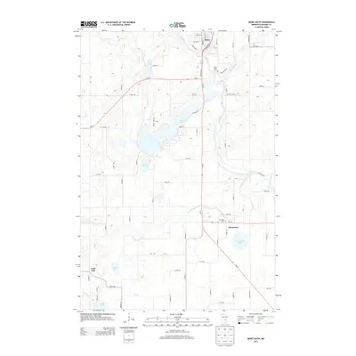
2013 Map of Mora South
USGS Topo · Published 2013About this map
The Snake River and its various tributaries define the hydrology of this Kanabec County landscape, where the southern portion of Mora serves as a primary hub. The map illustrates a complex network of waterways, including the meandering Groundhouse River and the Ann River, which feeds into the central Fish Lake. These rivers once played a critical role in the region's logging and transport history before the modern road grid, represented here by MN-65 and MN-23, became the dominant infrastructure.
Find a feature on this map
66 named features on this map. Tap any name to fly to it.
Don’t see what you’re looking for? This feature index may not catch every label — zoom into the map to look around manually.
Map Details
Editions of this 2013 Mora South Map
This is the sole edition of this map. No revisions or reprints were ever made.
Other maps of this area

1953 · Stillwater
USGS Topo · 1:250,000

1955 · Stillwater
USGS Topo · 1:250,000

1958 · Stillwater
USGS Topo · 1:250,000

1961 · Cambridge
USGS Topo · 1:62,500

1961 · Brook Park
USGS Topo · 1:62,500

1961 · Springvale
USGS Topo · 1:24,000

1961 · Dalbo
USGS Topo · 1:24,000

1961 · Dalbo
USGS Topo · 1:62,500

1965 · Stillwater
USGS Topo · 1:250,000

1968 · Ann Lake
USGS Topo · 1:24,000