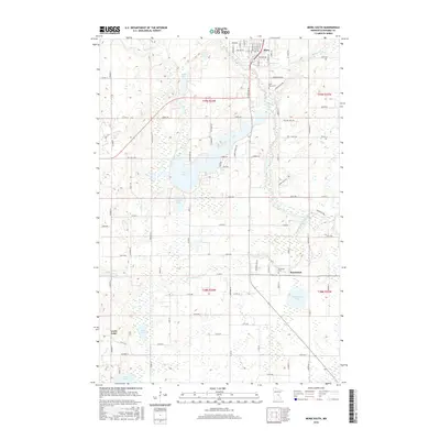
2016 Map of Mora South
USGS Topo · Published 2016About this map
The southern edge of Mora and the rural community of Brunswick anchor this survey of central Minnesota's lake-and-river landscape. The Snake River winds across the northern and eastern portions of the quadrangle, joined by its tributaries, the Ann River and the Groundhouse River. This waterway network historically dictated the placement of early settlements and roads in Kanabec County. The map provides a look at local burial grounds including Saint Marys Cem near the southern outskirts of Mora and Riverside Cem located near the banks of the Groundhouse River. Large water bodies such as Fish Lake, Rice Lake, and Lewis Lake dominate the western half of the terrain, surrounded by a dense grid of local roads like Old Hwy 23 W and Co Rd 47. These features reflect a landscape transitioned from its logging roots into a mix of seasonal lakefront residency and agricultural holdings.
Find a feature on this map
89 named features on this map. Tap any name to fly to it.
Don’t see what you’re looking for? This feature index may not catch every label — zoom into the map to look around manually.
Map Details
Editions of this 2016 Mora South Map
This is the sole edition of this map. No revisions or reprints were ever made.
Other maps of this area

1953 · Stillwater
USGS Topo · 1:250,000

1955 · Stillwater
USGS Topo · 1:250,000

1958 · Stillwater
USGS Topo · 1:250,000

1961 · Cambridge
USGS Topo · 1:62,500

1961 · Brook Park
USGS Topo · 1:62,500

1961 · Springvale
USGS Topo · 1:24,000

1961 · Dalbo
USGS Topo · 1:24,000

1961 · Dalbo
USGS Topo · 1:62,500

1965 · Stillwater
USGS Topo · 1:250,000

1968 · Ann Lake
USGS Topo · 1:24,000