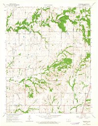
1963 Map of Morehead
USGS Topo · Published 1964About this map
The Old Indian Treaty Boundary slices diagonally across this Kansas landscape, a visible reminder of nineteenth-century land divisions that preceded the current township grid. The settlement of Morehead sits at the junction of four counties — Wilson, Neosho, Montgomery, and Labette — serving as a crossroads for the local agricultural and extraction economies. This 1963 survey shows an area heavily influenced by resource development, with numerous Oil Wells peppered across the townships of Newark and Shiloh, alongside a Quarry near the Neosho County line.
Find a feature on this map
29 named features on this map. Tap any name to fly to it.
Don’t see what you’re looking for? This feature index may not catch every label — zoom into the map to look around manually.
Map Details
Editions of this 1963 Morehead Map
2 editions found
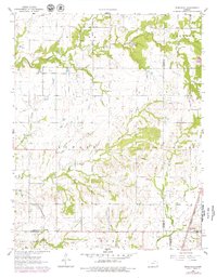
Other maps of this area

1886 · Fredonia
USGS Topo · 1:125,000

1886 · Iola
USGS Topo · 1:125,000

1886 · Independence
USGS Topo · 1:125,000

1886 · Parsons
USGS Topo · 1:125,000

1893 · Iola
USGS Topo · 1:125,000

1893 · Parsons
USGS Topo · 1:125,000

1894 · Fredonia
USGS Topo · 1:125,000

1894 · Independence
USGS Topo · 1:125,000

1904 · Iola
USGS Topo · 1:125,000

1905 · Independence
USGS Topo · 1:125,000