
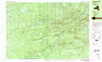
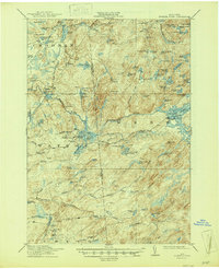
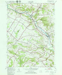
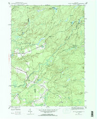
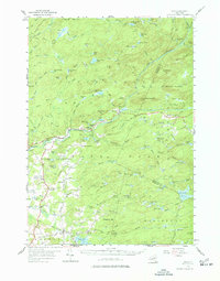
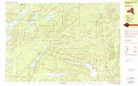
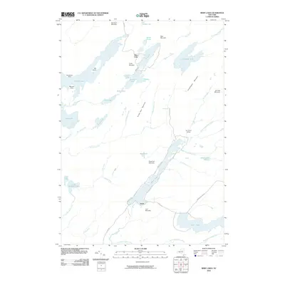
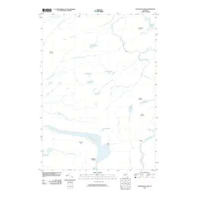
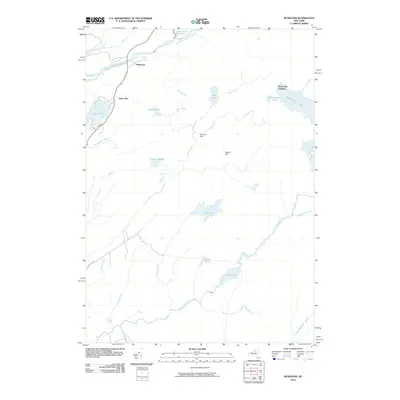
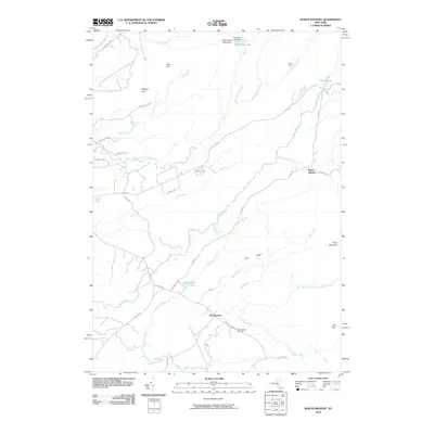
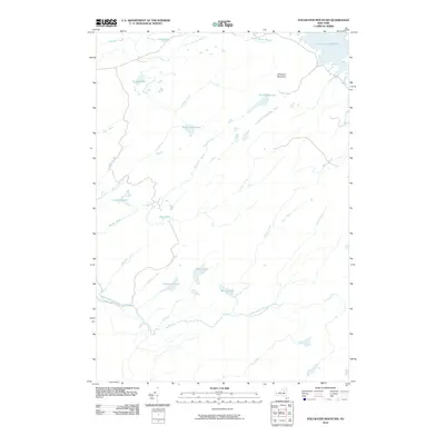
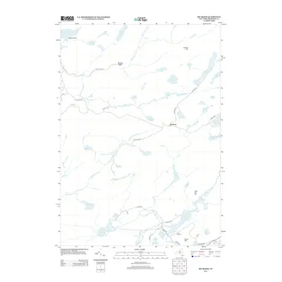
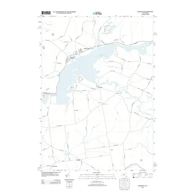
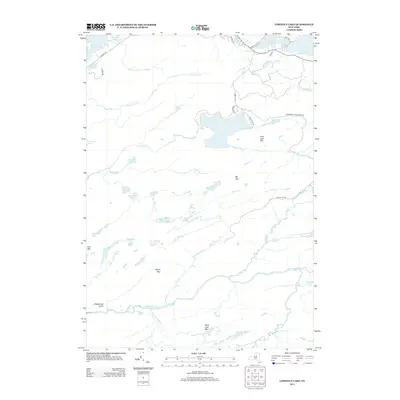
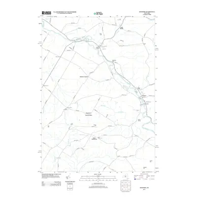
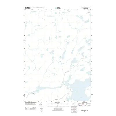
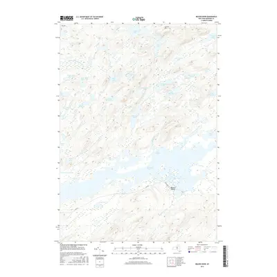
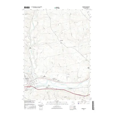
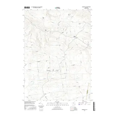
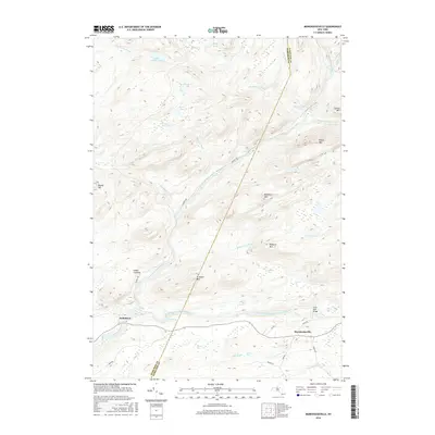
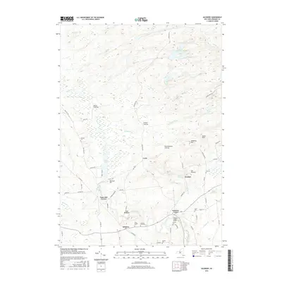
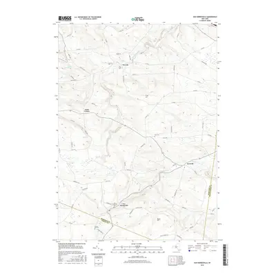
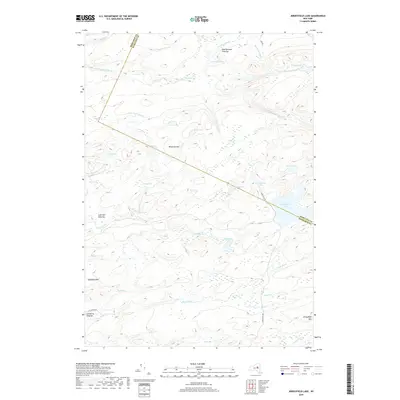
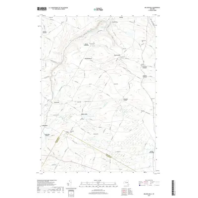
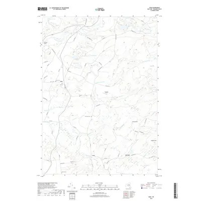
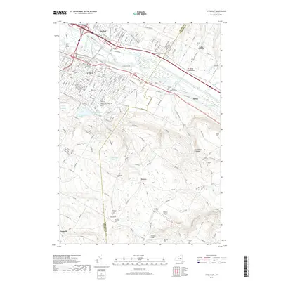
1989 Map of Morehouseville
USGS Topo · Published 1989About this map
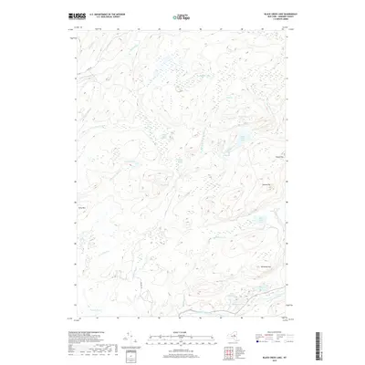
Morehouseville and Nobleboro stand as small interior settlements within the vast Adirondack Park at the edge of Herkimer and Hamilton counties. Surveyed in the late 1980s, this terrain is defined by a dense network of high-elevation wetlands and family-named peaks, including McCauley Mountain and Fort Noble Mtn. Water features dominate the landscape, from the expansive Black Creek Lake and Mill Creek Lake to smaller basins like Burp Lake and Finches Pond. The presence of numerous vlys, such as Whiskey Spring Vly and Bethune Vly, points to a landscape shaped by beaver activity and slow-draining glacial depressions. Transportation is limited to a few improved routes like South Branch, reflecting the remote character of these mountain communities during the late twentieth century.
Find a feature on this map
60 named features on this map. Tap any name to fly to it.
Don’t see what you’re looking for? This feature index may not catch every label — zoom into the map to look around manually.
Map Details
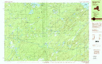
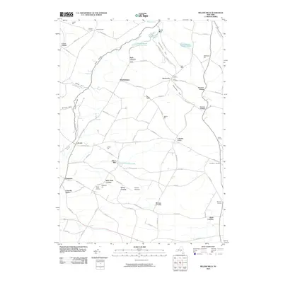
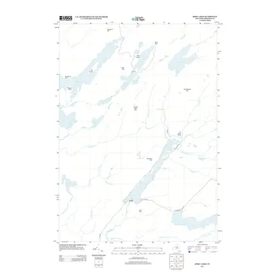
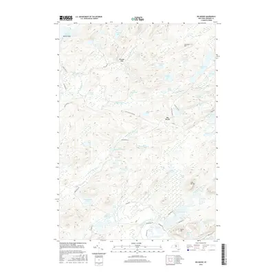
Editions of this 1989 Morehouseville Map
2 editions found
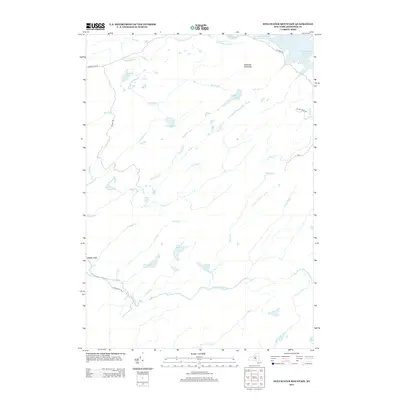
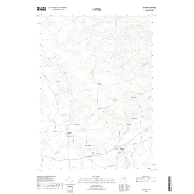
Historical Maps of Ohio Through Time
146 maps found

1900 Wilmurt
Herkimer County, NY
1902 Wilmurt
Herkimer County, NY
1903 Big Moose
Herkimer County, NY
1912 Mc Keever
Herkimer County, NY

1912 Number Four
Herkimer County, NY
1915 Number Four
Herkimer County, NY
1943 Herkimer
Herkimer County, NY
1943 Jordanville
Herkimer County, NY
1943 Millers Mills
Herkimer County, NY
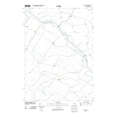
1943 Newport
Herkimer County, NY

1943 Utica East
Herkimer County, NY
1943 Van Hornesville
Herkimer County, NY

1945 Herkimer
Herkimer County, NY

1945 Jordanville
Herkimer County, NY

1945 Millers Mills
Herkimer County, NY

1945 Newport
Herkimer County, NY
1945 Salisbury
Herkimer County, NY

1945 Utica East
Herkimer County, NY

1945 Van Hornesville
Herkimer County, NY
1946 Hinckley
Herkimer County, NY

1946 Millers Mills
Herkimer County, NY
1946 North Wilmurt
Herkimer County, NY

1946 Salisbury
Herkimer County, NY
1947 Hinckley
Herkimer County, NY
1947 North Wilmurt
Herkimer County, NY

1949 Herkimer
Herkimer County, NY

1949 Millers Mills
Herkimer County, NY
1954 Big Moose
Herkimer County, NY
1954 Ohio
Herkimer County, NY
1955 Utica East
Herkimer County, NY
1957 Number Four
Herkimer County, NY
1958 Mc Keever
Herkimer County, NY

1982 Newport
Herkimer County, NY

1983 Utica East
Herkimer County, NY

1989 Beavers River
Herkimer County, NY
1989 Honnedaga Lake
Herkimer County, NY

1989 Mc Keever
Herkimer County, NY
1989 Morehouseville
Herkimer County, NY
1989 Number Four
Herkimer County, NY

1989 Ohio
Herkimer County, NY

1989 Stillwater
Herkimer County, NY
2010 Beaver River
Herkimer County, NY
2010 Big Moose
Herkimer County, NY
2010 Bisby Lakes
Herkimer County, NY
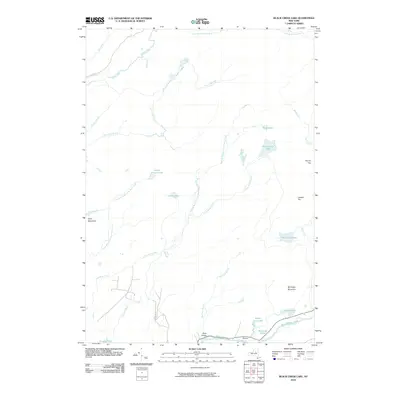
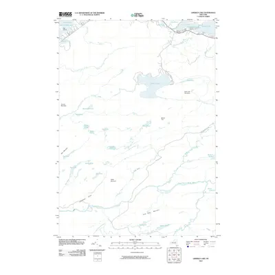
2010 Black Creek Lake
Herkimer County, NY
2010 Herkimer
Herkimer County, NY
2010 Hinckley
Herkimer County, NY
2010 Honnedaga Lake
Herkimer County, NY
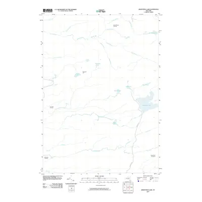
2010 Jerseyfield Lake
Herkimer County, NY
2010 Jordanville
Herkimer County, NY
2010 Limekiln Lake
Herkimer County, NY
2010 McKeever
Herkimer County, NY
2010 Millers Mills
Herkimer County, NY
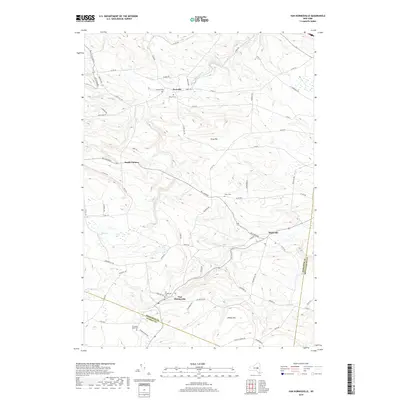
2010 Morehouseville
Herkimer County, NY
2010 Newport
Herkimer County, NY
2010 North Wilmurt
Herkimer County, NY
2010 Ohio
Herkimer County, NY
2010 Salisbury
Herkimer County, NY
2010 Stillwater
Herkimer County, NY
2010 Stillwater Mountain
Herkimer County, NY
2010 Van Hornesville
Herkimer County, NY
2011 Utica East
Herkimer County, NY
2013 Beaver River
Herkimer County, NY
2013 Big Moose
Herkimer County, NY
2013 Bisby Lakes
Herkimer County, NY
2013 Black Creek Lake
Herkimer County, NY
2013 Herkimer
Herkimer County, NY
2013 Hinckley
Herkimer County, NY
2013 Honnedaga Lake
Herkimer County, NY
2013 Jerseyfield Lake
Herkimer County, NY
2013 Jordanville
Herkimer County, NY
2013 Limekiln Lake
Herkimer County, NY
2013 McKeever
Herkimer County, NY
2013 Millers Mills
Herkimer County, NY
2013 Morehouseville
Herkimer County, NY
2013 Newport
Herkimer County, NY
2013 North Wilmurt
Herkimer County, NY
2013 Ohio
Herkimer County, NY
2013 Salisbury
Herkimer County, NY
2013 Stillwater
Herkimer County, NY
2013 Stillwater Mountain
Herkimer County, NY
2013 Utica East
Herkimer County, NY
2013 Van Hornesville
Herkimer County, NY
2016 Beaver River
Herkimer County, NY
2016 Big Moose
Herkimer County, NY
2016 Bisby Lakes
Herkimer County, NY
2016 Black Creek Lake
Herkimer County, NY
2016 Herkimer
Herkimer County, NY
2016 Hinckley
Herkimer County, NY
2016 Honnedaga Lake
Herkimer County, NY
2016 Jerseyfield Lake
Herkimer County, NY
2016 Jordanville
Herkimer County, NY
2016 Limekiln Lake
Herkimer County, NY
2016 McKeever
Herkimer County, NY
2016 Millers Mills
Herkimer County, NY
2016 Morehouseville
Herkimer County, NY
2016 Newport
Herkimer County, NY
2016 North Wilmurt
Herkimer County, NY
2016 Ohio
Herkimer County, NY
2016 Salisbury
Herkimer County, NY
2016 Stillwater
Herkimer County, NY
2016 Stillwater Mountain
Herkimer County, NY
2016 Utica East
Herkimer County, NY
2016 Van Hornesville
Herkimer County, NY
2019 Beaver River
Herkimer County, NY
2019 Big Moose
Herkimer County, NY
2019 Bisby Lakes
Herkimer County, NY
2019 Black Creek Lake
Herkimer County, NY
2019 Herkimer
Herkimer County, NY
2019 Hinckley
Herkimer County, NY
2019 Honnedaga Lake
Herkimer County, NY
2019 Jerseyfield Lake
Herkimer County, NY
2019 Jordanville
Herkimer County, NY
2019 Limekiln Lake
Herkimer County, NY
2019 McKeever
Herkimer County, NY
2019 Millers Mills
Herkimer County, NY
2019 Morehouseville
Herkimer County, NY
2019 Newport
Herkimer County, NY
2019 North Wilmurt
Herkimer County, NY
2019 Ohio
Herkimer County, NY
2019 Salisbury
Herkimer County, NY
2019 Stillwater
Herkimer County, NY
2019 Stillwater Mountain
Herkimer County, NY
2019 Utica East
Herkimer County, NY
2019 Van Hornesville
Herkimer County, NY

2023 Beaver River
Herkimer County, NY

2023 Big Moose
Herkimer County, NY

2023 Bisby Lakes
Herkimer County, NY
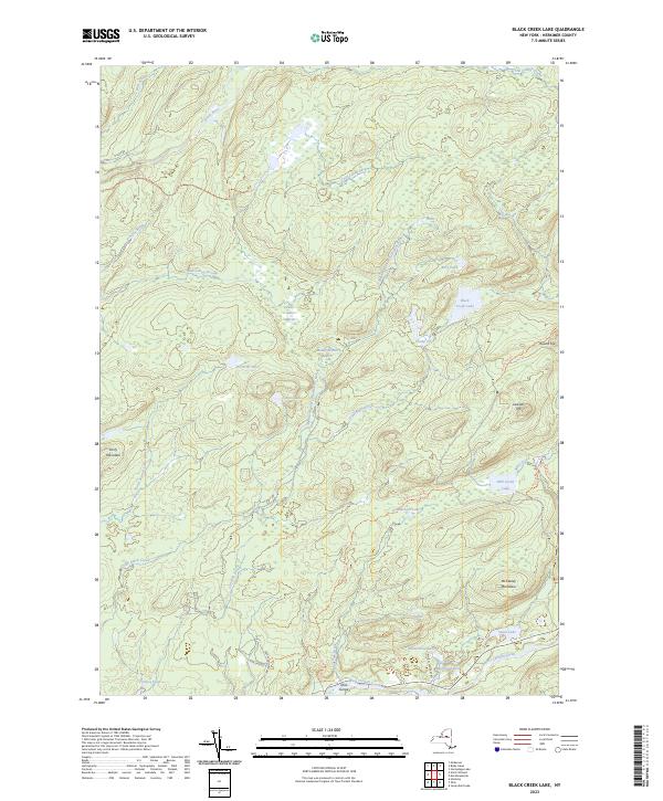
2023 Black Creek Lake
Herkimer County, NY

2023 Herkimer
Herkimer County, NY

2023 Hinckley
Herkimer County, NY

2023 Honnedaga Lake
Herkimer County, NY

2023 Jerseyfield Lake
Herkimer County, NY

2023 Jordanville
Herkimer County, NY

2023 Limekiln Lake
Herkimer County, NY
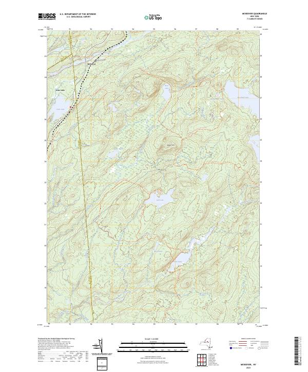
2023 McKeever
Herkimer County, NY

2023 Millers Mills
Herkimer County, NY

2023 Morehouseville
Herkimer County, NY

2023 Newport
Herkimer County, NY

2023 North Wilmurt
Herkimer County, NY

2023 Ohio
Herkimer County, NY

2023 Salisbury
Herkimer County, NY

2023 Stillwater
Herkimer County, NY

2023 Stillwater Mountain
Herkimer County, NY

2023 Utica East
Herkimer County, NY

2023 Van Hornesville
Herkimer County, NY