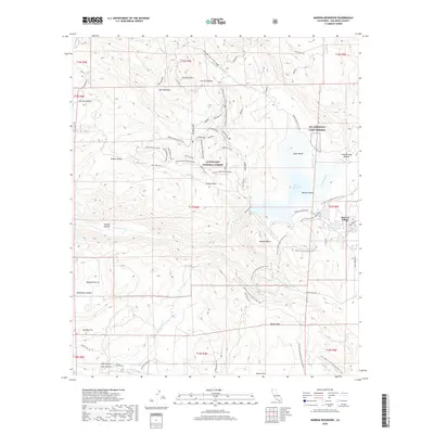
2018 Map of Morena Reservoir
USGS Topo · Published 2018About this map
The Morena Reservoir and its surrounding mountain terrain anchor this landscape within the Cleveland National Forest. In the east, Morena Village sits near the reservoir's edge, while NB Coronado Camp Morena provides a military presence at the base of Morena Butte. The area is defined by a dense network of trails and fire roads, including the Pacific Crest National Scenic Trail which winds through the rugged topography from Hauser Mtn toward the water. To the west, the map details the high meadows and valleys such as Spur Meadow and Stokes Valley, alongside distinctive peaks like Bronco Peak. Named tracks such as Gun Slinger and Gold Strike Singletrak hint at the area's recreational use and historical mining character. The drainage systems of Cottonwood Cr and Hauser Cr illustrate the complex hydrology feeding the reservoir basin.
Find a feature on this map
69 named features on this map. Tap any name to fly to it.
Don’t see what you’re looking for? This feature index may not catch every label — zoom into the map to look around manually.
Map Details
Editions of this 2018 Morena Reservoir Map
This is the sole edition of this map. No revisions or reprints were ever made.
Other maps of this area

1903 · Cuyamaca
USGS Topo · 1:125,000

1904 · Southern California Sheet No. 2
USGS Topo · 1:250,000

1931 · Carrizo
USGS Topo · 1:125,000

1939 · Campo
USGS Topo · 1:62,500

1942 · Potrero
USGS Topo · 1:48,000

1942 · Campo
USGS Topo · 1:62,500

1942 · Cuyapaipe
USGS Topo · 1:62,500

1942 · Cuyamaca Peak
USGS Topo · 1:62,500

1944 · Potrero
USGS Topo · 1:62,500

1944 · Cuyamaca Peak
USGS Topo · 1:62,500