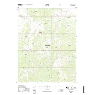
2018 Map of Morey Peak
USGS Topo · Published 2018About this map
Mahogany Peak and the high ridges of the Hot Creek Range dominate this 2018 survey of the Toiyabe National Forest in Nye County. The landscape is defined by its verticality, rising toward the prominent Morey Peak and Monitor Peak. The settlement of Morey sits on the eastern edge of the quadrangle, connected to the rugged interior by the Morey Canyon Road.
Find a feature on this map
58 named features on this map. Tap any name to fly to it.
Don’t see what you’re looking for? This feature index may not catch every label — zoom into the map to look around manually.
Map Details
Editions of this 2018 Morey Peak Map
This is the sole edition of this map. No revisions or reprints were ever made.
Other maps of this area

1956 · Tonopah
USGS Topo · 1:250,000

1959 · Tonopah
USGS Topo · 1:250,000

1962 · Tonopah
USGS Topo · 1:250,000

1967 · Moores Station
USGS Topo · 1:62,500

1967 · Upper Fish Lake
USGS Topo · 1:24,000

1967 · Moores Station
USGS Topo · 1:24,000

1967 · Morey Peak
USGS Topo · 1:24,000
1967 · Moores Station SW
USGS Topo · 1:24,000

1968 · Morey Peak
USGS Topo · 1:62,500

1968 · Pritchards Station
USGS Topo · 1:62,500