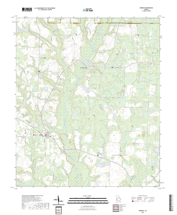
2024 Map of Morgan
USGS Topo · Published 2024About this map
Morgan serves as the focal point of this survey, anchored by the Calhoun County Courthouse at its center. The settlement patterns follow the winding path of Ichawaynochaway Creek, which flows through a landscape defined by significant water features like McClendon Lake and Merrett Pond. The map reveals a deeply established rural community, evidenced by the numerous church-affiliated burial sites scattered across the county lines of Randolph and Terrell.
Find a feature on this map
64 named features on this map. Tap any name to fly to it.
Don’t see what you’re looking for? This feature index may not catch every label — zoom into the map to look around manually.
Map Details
Editions of this 2024 Morgan Map
This is the sole edition of this map. No revisions or reprints were ever made.
Other maps of this area

1953 · Dothan
USGS Topo · 1:250,000

1954 · Dothan
USGS Topo · 1:250,000

1955 · Dothan
USGS Topo · 1:250,000

1956 · Newton
USGS Topo · 1:62,500

1956 · Sasser
USGS Topo · 1:62,500

1973 · Morgan
USGS Topo · 1:24,000

1973 · Chickasawhatchee
USGS Topo · 1:24,000

1973 · Martins Crossroads
USGS Topo · 1:24,000
1973 · Holt
USGS Topo · 1:24,000
1973 · Doverel
USGS Topo · 1:24,000