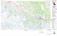
1983 Map of Morgan City
USGS Topo · Published 1983About this map
Bayou Teche winds through the heart of this coastal landscape, serving as a historic spine for settlements like Jeanerette and Franklin. This 1983 topographic-bathymetric study captures the complex intersection of South Louisiana's industrial and natural environments, from the high ground of salt domes at Avery Island and Weeks Island to the expansive wetlands of the Atchafalaya Basin Floodway. The map details a period of significant maritime and energy-related infrastructure, showing the critical role of the Intracoastal Waterway and the Southern Pacific Railroad in connecting towns such as Morgan City and Patterson to broader markets. The inclusion of bathymetric contours throughout Atchafalaya Bay and Vermilion Bay reveals the underwater topography essential for navigating these shallow coastal waters, while the boundaries of the Russell Sage Foundation Marsh Island State Wildlife Refuge highlight the region's commitment to conservation amidst its industrial growth.
Find a feature on this map
77 named features on this map. Tap any name to fly to it.
Don’t see what you’re looking for? This feature index may not catch every label — zoom into the map to look around manually.
Map Details
Editions of this 1983 Morgan City Map
2 editions found
Other maps of this area

1892 · Gibson
USGS Topo · 1:62,500

1892 · Donaldsonville
USGS Topo · 1:62,500

1892 · Thibodaux
USGS Topo · 1:62,500

1894 · Bayou De Large
USGS Topo · 1:62,500

1897 · Gibson
USGS Topo · 1:62,500

1927 · Thibodaux NW
USGS Topo · 1:31,680

1932 · Lake Decade
USGS Topo · 1:62,500

1932 · Bayou Blanc
USGS Topo · 1:31,680

1932 · Abbeville SE
USGS Topo · 1:31,680

1932 · Abbeville NE
USGS Topo · 1:31,680