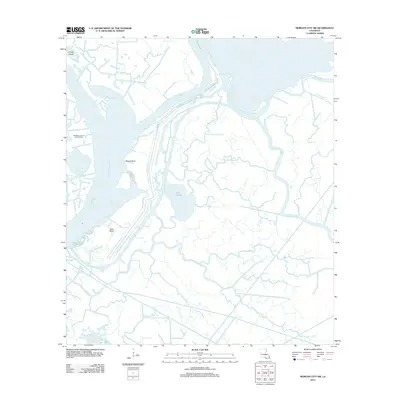
2012 Map of Morgan City SW
USGS Topo · Published 2012About this map
Lower Atchafalaya River currents and intricate wetland hydrology dominate this 2012 survey of southwestern Terrebonne Parish. The landscape is a labyrinth of natural and engineered waterways, where the Avoca Island Cutoff and Bayou Shaffer facilitate industrial and waterborne transit through the marsh. This era of the region’s development is characterized by the presence of the Sweetbay Lake Oil and Gas Field and a complex levee system, including Levee Rd, protecting the low-lying terrain from the surrounding basin waters. Smaller features like Lake Gascha and the distinctively named Sword Point and East Bend provide essential reference points for navigating the shifting alluvial environment. Numerous smaller bayous, such as Big Horn Bayou and Little Horn Bayou, illustrate the secondary drainage patterns that define the local topography south of Morgan City.
Find a feature on this map
25 named features on this map. Tap any name to fly to it.
Don’t see what you’re looking for? This feature index may not catch every label — zoom into the map to look around manually.
Map Details
Editions of this 2012 Morgan City SW Map
This is the sole edition of this map. No revisions or reprints were ever made.
Other maps of this area

1932 · Lake Decade
USGS Topo · 1:62,500

1935 · Morgan City
USGS Topo · 1:62,500

1941 · Belle Isle
USGS Topo · 1:62,500

1945 · New Orleans
USGS Topo · 1:250,000

1954 · Morgan City
USGS Topo · 1:62,500

1954 · Belle Isle
USGS Topo · 1:62,500

1957 · Lake Decade
USGS Topo · 1:62,500

1957 · Point Au Fer
USGS Topo · 1:62,500

1963 · New Orleans
USGS Topo · 1:250,000

1966 · New Orleans
USGS Topo · 1:250,000