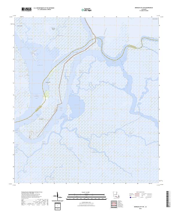
2024 Map of Morgan City SW
USGS Topo · Published 2024About this map
Avoca Island and its surrounding wetlands dominate this coastal reach of the St. Mary Parish and Terrebonne Parish line. This landscape is a complex network of bayous and islands at the mouth of the Lower Atchafalaya River, where human infrastructure like the Avoca Island Cutoff and Levee Rd meets the natural flow of the delta. Large interior water bodies such as Sweetbay Lake and Lake Gascha are separated by narrow landforms like Sword Point. The map documents the intricate hydrography of the region, tracing the paths of the Bayou Penchant, Bayou Shaffer, and Bayou Lawrence as they move through the marshy terrain towards the Gulf. This 2024 edition reflects the contemporary state of these vital Louisiana wetlands, capturing the current relationship between navigation channels and the shifting deltaic environment.
Find a feature on this map
35 named features on this map. Tap any name to fly to it.
Don’t see what you’re looking for? This feature index may not catch every label — zoom into the map to look around manually.
Map Details
Editions of this 2024 Morgan City SW Map
This is the sole edition of this map. No revisions or reprints were ever made.
Other maps of this area

1932 · Lake Decade
USGS Topo · 1:62,500

1935 · Morgan City
USGS Topo · 1:62,500

1941 · Belle Isle
USGS Topo · 1:62,500

1945 · New Orleans
USGS Topo · 1:250,000

1954 · Morgan City
USGS Topo · 1:62,500

1954 · Belle Isle
USGS Topo · 1:62,500

1957 · Lake Decade
USGS Topo · 1:62,500

1957 · Point Au Fer
USGS Topo · 1:62,500

1963 · New Orleans
USGS Topo · 1:250,000

1966 · New Orleans
USGS Topo · 1:250,000