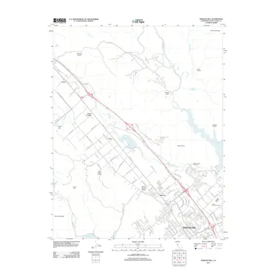
2012 Map of Morgan Hill
USGS Topo · Published 2012About this map
Morgan Hill serves as the focal point for this Santa Clara County study, which follows the Santa Clara Valley's transition from agricultural roots to modern development. The landscape is defined by the course of Coyote Cr, flowing northwest toward San Jose, and the reservoir systems at Anderson Lake and Chesbro Reservoir. A string of historic settlements along the Monterey Rd corridor, including Coyote, South Coyote, Perry, and Madrone, reflects the area's long-standing role as a transportation artery connecting the south bay to the Central Coast. Local industry and land use are represented by landmarks such as the Emilio Guglielmo Winery and the William F James Boys Ranch. The terrain rises sharply away from the valley floor into the heights of Manzanita Ridge and Henderson Ridge, where several canyons like Metcalfe Canyon and San Bruno Canyon cut through the hills.
Find a feature on this map
96 named features on this map. Tap any name to fly to it.
Don’t see what you’re looking for? This feature index may not catch every label — zoom into the map to look around manually.
Map Details
Editions of this 2012 Morgan Hill Map
This is the sole edition of this map. No revisions or reprints were ever made.
Other maps of this area

1889 · San Jose
USGS Topo · 1:62,500

1897 · San Jose
USGS Topo · 1:62,500

1897 · Mt. Hamilton
USGS Topo · 1:62,500

1899 · San Jose
USGS Topo · 1:62,500

1916 · New Almaden
USGS Topo · 1:48,000

1917 · Morgan Hill
USGS Topo · 1:62,500

1919 · New Almaden
USGS Topo · 1:62,500

1939 · Morgan Hill
USGS Topo · 1:62,500

1940 · Los Gatos
USGS Topo · 1:62,500

1941 · Morgan Hill
USGS Topo · 1:62,500