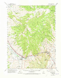
1961 Map of Morgan
USGS Topo · Published 1973About this map
The Weber River defines the lower valley corridor of this early 1960s survey, anchoring a network of agriculture and industry through Morgan and Henefer. The heavy infrastructure of the Union Pacific Railroad tracks the river's course, supporting the industrial activity at Devils Slide, where a Cement Plant and Quarry sit near the canyon entrance. In the Upper Weber Valley, irrigation projects like the Stoddard Diversion Dam and the South Bench Canal distribute water across the valley floor, sustaining settlements like Milton, Littleton, and Richville.
Find a feature on this map
76 named features on this map. Tap any name to fly to it.
Don’t see what you’re looking for? This feature index may not catch every label — zoom into the map to look around manually.
Map Details
Editions of this 1961 Morgan Map
2 editions found

Other maps of this area

1885 · Salt Lake
USGS Topo · 1:250,000

1900 · Coalville
USGS Topo · 1:125,000

1903 · Coalville
USGS Topo · 1:125,000

1925 · Ft. Douglas
USGS Topo · 1:125,000

1928 · Ft. Douglas
USGS Topo · 1:125,000

1952 · Bountiful Peak
USGS Topo · 1:24,000

1954 · Salt Lake City
USGS Topo · 1:250,000

1954 · Ogden
USGS Topo · 1:250,000

1955 · Peterson
USGS Topo · 1:24,000

1955 · Huntsville
USGS Topo · 1:24,000