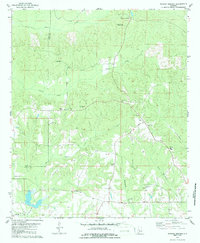
1979 Map of Morgan Springs
USGS Topo · Published 1986About this map
Morgan Springs and the nearby community of Folsom anchor this rural landscape in western Alabama along the Hale Co and Perry Co line. A high density of rural churches and family-named cemeteries, such as Mt Carmel Ch and the Harper Cem, indicates a deeply rooted agricultural society. The presence of the Morgan Springs Lookout Tower on a high point overlooking the headwaters of Brush Creek reflects the era's focus on forest management and fire protection in the region's timbered hills.
Find a feature on this map
29 named features on this map. Tap any name to fly to it.
Don’t see what you’re looking for? This feature index may not catch every label — zoom into the map to look around manually.
Map Details
Editions of this 1979 Morgan Springs Map
2 editions found
Other maps of this area

1953 · Montgomery
USGS Topo · 1:250,000

1956 · Montgomery
USGS Topo · 1:250,000

1957 · Montgomery
USGS Topo · 1:250,000

1979 · Marion North
USGS Topo · 1:24,000

1979 · Scott Station
USGS Topo · 1:24,000

1979 · Morgan Springs
USGS Topo · 1:24,000

1979 · Marion South
USGS Topo · 1:24,000

1979 · Greensboro
USGS Topo · 1:24,000

1980 · Ingram
USGS Topo · 1:24,000
1980 · Newbern
USGS Topo · 1:24,000