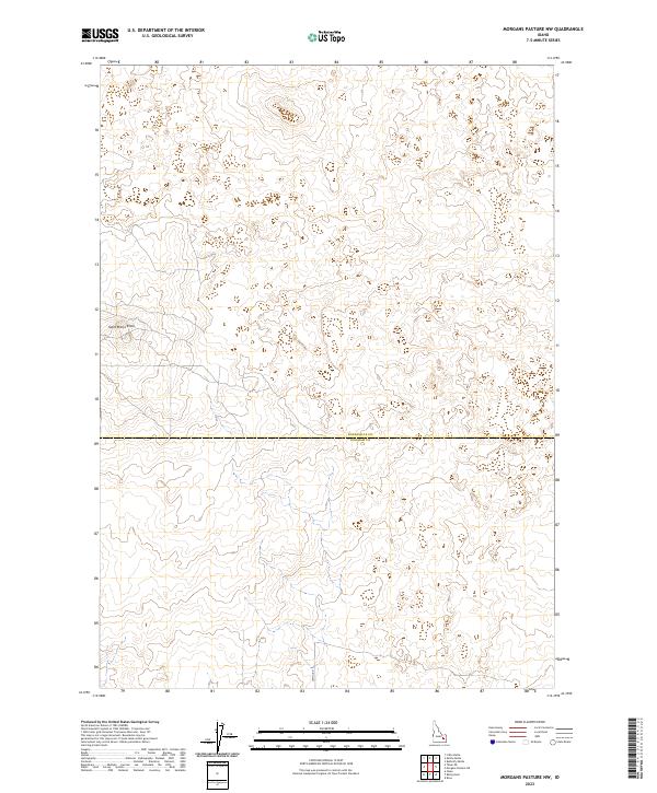
2023 Map of Morgans Pasture NW
USGS Topo · Published 2023About this map
Saint Marys Knoll stands as a prominent topographical feature in this high-desert landscape, located just north of the political boundary between Bonneville Co and Bingham Co. The terrain is defined by a series of subtle depressions and rises, characteristic of the upper Snake River Plain's volcanic geology. Modern access to this sparsely populated region is facilitated by Lemhi Rd, which cuts through the southern portion of the quadrangle. This 2023 survey illustrates the continued importance of the Public Land Survey System in organizing the Idaho interior, clearly marking the township and range divisions such as t2n r34e and t1n r34e that have governed land ownership and grazing rights for generations.
Find a feature on this map
7 named features on this map. Tap any name to fly to it.
Don’t see what you’re looking for? This feature index may not catch every label — zoom into the map to look around manually.
Map Details
Editions of this 2023 Morgans Pasture NW Map
This is the sole edition of this map. No revisions or reprints were ever made.
Other maps of this area

1955 · Baldy Knoll
USGS Topo · 1:24,000

1955 · Rose
USGS Topo · 1:24,000

1955 · Idaho Falls
USGS Topo · 1:250,000

1958 · Idaho Falls
USGS Topo · 1:250,000

1964 · Kettle Butte SW
USGS Topo · 1:24,000
1964 · Morgans Pasture NE
USGS Topo · 1:24,000
1964 · Butterfly Butte
USGS Topo · 1:24,000

1973 · Olsen
USGS Topo · 1:24,000

1973 · Little Butte
USGS Topo · 1:24,000

1973 · Taber NE
USGS Topo · 1:24,000