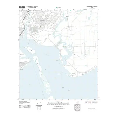
2010 Map of Morgans Point
USGS Topo · Published 2010About this map
Baytown and the surrounding coastal industrial landscape dominate this 2010 survey, showcasing the dense street grids of neighborhoods like Pelly and Roseland Manor. The shoreline is defined by its deep relationship with the petroleum industry, evidenced by the Goose Creek Oil Field and the Cedar Point Oil Field. Along the waterfront, the Morgans Point Historic District stands as a distinct cultural landmark near the mouth of the San Jacinto River, where it meets the shipping lanes of the Cedar Bayou Channel.
Find a feature on this map
53 named features on this map. Tap any name to fly to it.
Don’t see what you’re looking for? This feature index may not catch every label — zoom into the map to look around manually.
Map Details
Editions of this 2010 Morgans Point Map
This is the sole edition of this map. No revisions or reprints were ever made.
Other maps of this area

1916 · Burnett Bay
USGS Topo · 1:24,000

1916 · Morgan Point
USGS Topo · 1:24,000

1916 · Seabrook
USGS Topo · 1:24,000

1916 · Cedar Bayou
USGS Topo · 1:24,000

1916 · La Porte
USGS Topo · 1:24,000

1919 · Morgan Point
USGS Topo · 1:31,680

1919 · Cedar Bayou
USGS Topo · 1:31,680

1920 · Seabrook
USGS Topo · 1:31,680

1920 · La Porte
USGS Topo · 1:31,680

1920 · Highlands
USGS Topo · 1:31,680