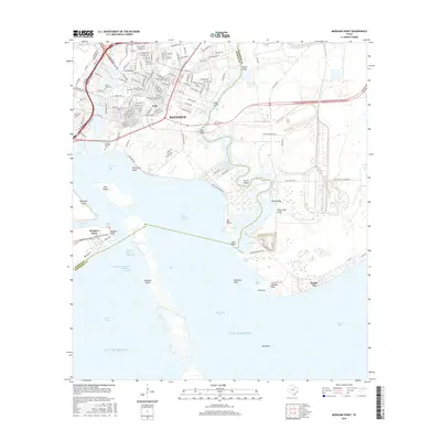
2016 Map of Morgans Point
USGS Topo · Published 2016About this map
The industrial and maritime corridors of Baytown meet the complex wetlands of the Texas coast in this 2016 survey. The map details the intensive intersection of land and water, where the Houston Ship Channel and Cedar Bayou Channel facilitate heavy commerce alongside protected ecological features like Fisher Marsh and Swan Marsh. Residential streets in neighborhoods such as Pelly and Morgans Point sit just inland from the vast expanse of Galveston Bay and Trinity Bay.
Find a feature on this map
170 named features on this map. Tap any name to fly to it.
Don’t see what you’re looking for? This feature index may not catch every label — zoom into the map to look around manually.
Map Details
Editions of this 2016 Morgans Point Map
This is the sole edition of this map. No revisions or reprints were ever made.
Other maps of this area

1916 · Burnett Bay
USGS Topo · 1:24,000

1916 · Morgan Point
USGS Topo · 1:24,000

1916 · Seabrook
USGS Topo · 1:24,000

1916 · Cedar Bayou
USGS Topo · 1:24,000

1916 · La Porte
USGS Topo · 1:24,000

1919 · Morgan Point
USGS Topo · 1:31,680

1919 · Cedar Bayou
USGS Topo · 1:31,680

1920 · Seabrook
USGS Topo · 1:31,680

1920 · La Porte
USGS Topo · 1:31,680

1920 · Highlands
USGS Topo · 1:31,680