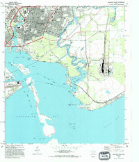
1993 Map of Morgans Point
USGS Topo · Published 1994About this map
The industrial and coastal character of the Harris and Chambers County border is recorded here in the early 1990s. Heavy industry and maritime commerce dominate the landscape, from the massive Refinery complex in the northwest to the intricate Cedar Bayou Channel and numerous oil wells dotting Tabbs Bay. The established grid of Baytown is depicted with detailed street names like Texas Ave and Market St, while local institutions such as Lee College and Memorial Stadium serve as community hubs.
Find a feature on this map
69 named features on this map. Tap any name to fly to it.
Don’t see what you’re looking for? This feature index may not catch every label — zoom into the map to look around manually.
Map Details
Editions of this 1993 Morgans Point Map
This is the sole edition of this map. No revisions or reprints were ever made.
Other maps of this area

1916 · Burnett Bay
USGS Topo · 1:24,000

1916 · Morgan Point
USGS Topo · 1:24,000

1916 · Seabrook
USGS Topo · 1:24,000

1916 · Cedar Bayou
USGS Topo · 1:24,000

1916 · La Porte
USGS Topo · 1:24,000

1919 · Morgan Point
USGS Topo · 1:31,680

1919 · Cedar Bayou
USGS Topo · 1:31,680

1920 · Seabrook
USGS Topo · 1:31,680

1920 · La Porte
USGS Topo · 1:31,680

1920 · Highlands
USGS Topo · 1:31,680