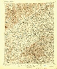
1905 Map of Morganton
USGS Topo · Published 1945About this map
Morganton serves as the central hub of this early 20th-century landscape, positioned at the intersection of the Southern Railway and the Catawba River. The map documents a period of significant regional organization, with the Pisgah National Forest spanning the mountainous northwestern reaches near Linville Falls and Jonas Ridge. Educational and industrial foundations are visible through the placement of Amherst College and Rutherford College, alongside established manufacturing and textile communities like Valdese and Lenoir.
Find a feature on this map
118 named features on this map. Tap any name to fly to it.
Don’t see what you’re looking for? This feature index may not catch every label — zoom into the map to look around manually.
Map Details
Editions of this 1905 Morganton Map
2 editions found

Other maps of this area

1889 · Wilkesboro
USGS Topo · 1:125,000

1891 · Roan Mountain
USGS Topo · 1:125,000

1891 · Wilkesboro
USGS Topo · 1:125,000

1893 · Cranberry
USGS Topo · 1:125,000

1894 · Roan Mountain
USGS Topo · 1:125,000

1895 · Hickory
USGS Topo · 1:125,000

1895 · Cranberry
USGS Topo · 1:125,000

1899 · Cranberry
USGS Topo · 1:125,000

1900 · Mount Mitchell
USGS Topo · 1:125,000

1902 · Cranberry
USGS Topo · 1:125,000