
Loading...
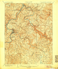
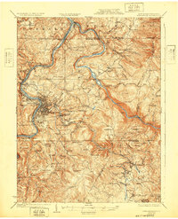
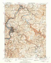
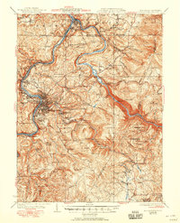
Loading map...1902 Map of Morgantown
USGS Topo · Published 1902About this map
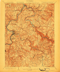
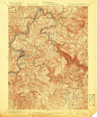
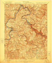
Morgantown sits at the heart of this turn-of-the-century river corridor, where the Monongahela River meets a landscape defined by early Appalachian industry and transport. The map reveals a transition from river-based commerce to heavy rail, with the Baltimore and Ohio RR and the Morgantown and Kingwood RR snaking through steep valleys. Significant industrial history is evident in the presence of Clinton Furnace and Clay Furnace, alongside the Laurel Iron Works, reflecting the region's early iron production era.
Find a feature on this map
66 named features on this map. Tap any name to fly to it.
Don’t see what you’re looking for? This feature index may not catch every label — zoom into the map to look around manually.
Map Details
Date Portrayed1902
Date Published1902
PublisherU.S. Geological Survey
Map TypeTopographic
Scale1:62500
Physical Dimensions16.5 x 19.8 inches
Editions of this 1902 Morgantown Map
5 editions found
Historical Maps of Virginia Manor Through Time
5 maps found

Featured Locations
Source Details
SourceU.S. Geological Survey
CopyrightPublic Domain