Loading...
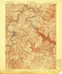
Loading map...1902 Map of Morgantown
USGS Topo · Published 1918About this map
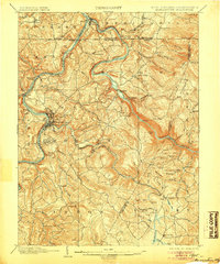
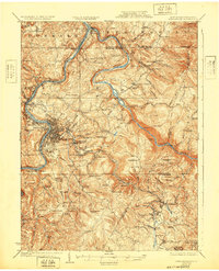
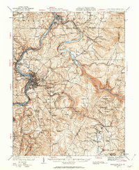
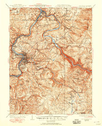
The Monongahela River and Cheat River define this early twentieth-century landscape, centering on Morgantown at the confluence of river traffic and rail. The town is anchored by the University and the State Farm, while the surrounding terrain of the Chestnut Ridge reveals a burgeoning industrial corridor. Along Deckers Creek, the Morgantown and Kingwood RR services several industrial sites, including Richard and Dellslow.
Find a feature on this map
83 named features on this map. Tap any name to fly to it.
Don’t see what you’re looking for? This feature index may not catch every label — zoom into the map to look around manually.
Map Details
Date Portrayed1902
Date Published1918
PublisherU.S. Geological Survey
Map TypeTopographic
Scale1:62,500
Physical Dimensions16.5 x 19.8 inches
Editions of this 1902 Morgantown Map
5 editions found

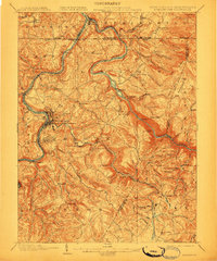
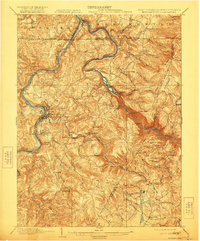
Historical Maps of Morgantown Through Time
5 maps found

Featured Locations
Source Details
SourceU.S. Geological Survey
CopyrightPublic Domain