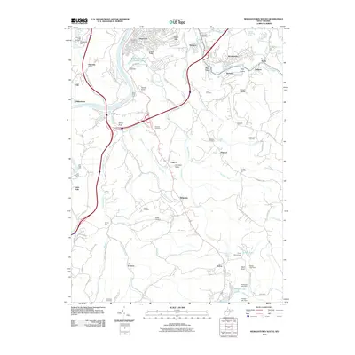
2011 Map of Morgantown South
USGS Topo · Published 2011About this map
The Monongahela River carves the western edge of this West Virginia landscape, providing a primary corridor for the industry and transport that shaped the region. South of the city center, communities like South Park and Hopecrest sit near the river's bend, while the eastern hills are dotted with scattered settlements and family cemeteries. The mapping of the Weirton Mine and Clinton Furnace underscores the area's legacy of extraction and iron production, which once anchored local labor.
Find a feature on this map
116 named features on this map. Tap any name to fly to it.
Don’t see what you’re looking for? This feature index may not catch every label — zoom into the map to look around manually.
Map Details
Editions of this 2011 Morgantown South Map
This is the sole edition of this map. No revisions or reprints were ever made.
Other maps of this area

1886 · St. George
USGS Topo · 1:125,000

1891 · St. George
USGS Topo · 1:125,000

1902 · Fairmont
USGS Topo · 1:62,500

1902 · Morgantown
USGS Topo · 1:62,500

1904 · Blacksville
USGS Topo · 1:62,500

1907 · Thornton
USGS Topo · 1:62,500

1923 · Blacksville
USGS Topo · 1:62,500

1923 · Fairmont
USGS Topo · 1:62,500

1925 · Blacksville
USGS Topo · 1:62,500

1925 · Morgantown
USGS Topo · 1:62,500