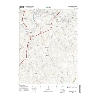
2016 Map of Morgantown South
USGS Topo · Published 2016About this map
The Monongahela River carves through the heart of this Monongalia County landscape, dividing Morgantown and Westover while serving as a central corridor for industry and recreation. In the northern reaches, established urban neighborhoods like South Hills and West Sabraton give way to a network of steep hollows and ridges to the south. Modern infrastructure is prominent, including the Jack Fleming Memorial Bridge and the Corporal Thomas Bennett Bridge, yet the map preserves numerous historical markers. Genealogists will find a high density of burial sites such as Lawnwood Cem, Oak Grove Cem, and McBee Cem. The transition from the river-valley settlements of Uffington and Little Falls to the higher elevations of Ridgedale and Clinton Furnace illustrates the region's diverse topography, where landmarks like Dorsey Knob and Raven Rock overlook winding runs and creeks.
Find a feature on this map
108 named features on this map. Tap any name to fly to it.
Don’t see what you’re looking for? This feature index may not catch every label — zoom into the map to look around manually.
Map Details
Editions of this 2016 Morgantown South Map
This is the sole edition of this map. No revisions or reprints were ever made.
Other maps of this area

1886 · St. George
USGS Topo · 1:125,000

1891 · St. George
USGS Topo · 1:125,000

1902 · Fairmont
USGS Topo · 1:62,500

1902 · Morgantown
USGS Topo · 1:62,500

1904 · Blacksville
USGS Topo · 1:62,500

1907 · Thornton
USGS Topo · 1:62,500

1923 · Blacksville
USGS Topo · 1:62,500

1923 · Fairmont
USGS Topo · 1:62,500

1925 · Blacksville
USGS Topo · 1:62,500

1925 · Morgantown
USGS Topo · 1:62,500