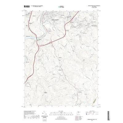
2019 Map of Morgantown South
USGS Topo · Published 2019About this map
Morgantown and its southern suburbs occupy the steep, dissected terrain along the Monongahela River, where modern recreational corridors like the Mon River S Rail-Trail and the Caperton Rail-Trail trace the paths of former industrial transport. The landscape is dotted with historical markers of early settlement and industry, such as Clinton Furnace and the Corporal Thomas Bennett Bridge. To the south and east, the map reveals a complex network of small hollows and ridges defined by Booths Creek, Cobun Creek, and Deckers Creek, providing a detailed look at the geography surrounding landmarks like Dorsey Knob and Raven Rock. Genealogists will find a high density of burial grounds throughout the area, from large established sites like Oak Grove Cemetery and Lawnwood Cemetery to smaller rural plots including McBee Cemetery and Summers Cemetery.
Find a feature on this map
68 named features on this map. Tap any name to fly to it.
Don’t see what you’re looking for? This feature index may not catch every label — zoom into the map to look around manually.
Map Details
Editions of this 2019 Morgantown South Map
This is the sole edition of this map. No revisions or reprints were ever made.
Other maps of this area

1886 · St. George
USGS Topo · 1:125,000

1891 · St. George
USGS Topo · 1:125,000

1902 · Fairmont
USGS Topo · 1:62,500

1902 · Morgantown
USGS Topo · 1:62,500

1904 · Blacksville
USGS Topo · 1:62,500

1907 · Thornton
USGS Topo · 1:62,500

1923 · Blacksville
USGS Topo · 1:62,500

1923 · Fairmont
USGS Topo · 1:62,500

1925 · Blacksville
USGS Topo · 1:62,500

1925 · Morgantown
USGS Topo · 1:62,500