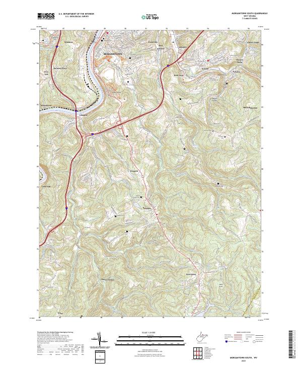
2023 Map of Morgantown South
USGS Topo · Published 2023About this map
The Monongahela River carves through the western edge of this landscape, serving as a primary corridor for both the Monongahela River Rail-Trl and modern transit routes. South of Morgantown, the terrain rises toward significant heights like Dorsey Knob and Bald Knob, with the rural character of the region defined by scattered settlements such as Clinton Furnace and Ridgedale. The transition from the urban reach of South Hills and Sabraton to the winding valleys of Booths Creek and Cobun Creek highlights a pattern of highland development and valley agriculture.
Find a feature on this map
79 named features on this map. Tap any name to fly to it.
Don’t see what you’re looking for? This feature index may not catch every label — zoom into the map to look around manually.
Map Details
Editions of this 2023 Morgantown South Map
This is the sole edition of this map. No revisions or reprints were ever made.
Other maps of this area

1886 · St. George
USGS Topo · 1:125,000

1891 · St. George
USGS Topo · 1:125,000

1902 · Fairmont
USGS Topo · 1:62,500

1902 · Morgantown
USGS Topo · 1:62,500

1904 · Blacksville
USGS Topo · 1:62,500

1907 · Thornton
USGS Topo · 1:62,500

1923 · Blacksville
USGS Topo · 1:62,500

1923 · Fairmont
USGS Topo · 1:62,500

1925 · Blacksville
USGS Topo · 1:62,500

1925 · Morgantown
USGS Topo · 1:62,500