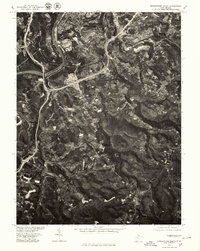
1976 Map of Morgantown South
USGS Topo · Published 1979About this map
The Monongahela River carves a dramatic path through the northwestern corner of this orthophotoquad, serving as the historical anchor for the southern reaches of Morgantown. This mid-1970s aerial perspective reveals the dense suburban development pushing eastward toward Brookhaven and Dellslow, while the southern portion of the quadrangle remains dominated by the deeply wooded ridges and valleys of Ridgedale. The imagery provides a distinct view of the evolving transportation corridor along Deckers Creek, where industry and infrastructure follow the natural contours of the West Virginia landscape. This specific survey, produced in cooperation with the Soil Conservation Service, captures the exact patterns of land use and forest cover before decades of further expansion altered these Monongalia County hillsides.
Find a feature on this map
6 named features on this map. Tap any name to fly to it.
Don’t see what you’re looking for? This feature index may not catch every label — zoom into the map to look around manually.
Map Details
Editions of this 1976 Morgantown South Map
This is the sole edition of this map. No revisions or reprints were ever made.
Other maps of this area

1886 · St. George
USGS Topo · 1:125,000

1891 · St. George
USGS Topo · 1:125,000

1902 · Fairmont
USGS Topo · 1:62,500

1902 · Morgantown
USGS Topo · 1:62,500

1904 · Blacksville
USGS Topo · 1:62,500

1907 · Thornton
USGS Topo · 1:62,500

1923 · Blacksville
USGS Topo · 1:62,500

1923 · Fairmont
USGS Topo · 1:62,500

1925 · Blacksville
USGS Topo · 1:62,500

1925 · Morgantown
USGS Topo · 1:62,500