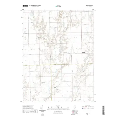
2021 Map of Moriah
USGS Topo · Published 2021About this map
Moriah and Hogue Town sit at the center of this rural landscape where the North Fork Embarras River carves a winding path through the borderlands of Clark, Jasper, and Crawford counties. The terrain is defined by a dense network of country roads and small, family-associated burial grounds that speak to a long history of local settlement. Genealogists can find numerous sites including Mount Cem, Baughman Cem, and Backbone Cem tucked away between the drainages of Mount Br and Willow Cr. To the east, the curiously named settlement of Moonshine anchors a junction of farm roads, while Bellair marks the southern reach of the survey. The geography remains largely defined by its natural watercourses, with Panther Cr and Little Willow Cr framing a region dedicated to agriculture and interconnected rural communities.
Find a feature on this map
77 named features on this map. Tap any name to fly to it.
Don’t see what you’re looking for? This feature index may not catch every label — zoom into the map to look around manually.
Map Details
Editions of this 2021 Moriah Map
This is the sole edition of this map. No revisions or reprints were ever made.
Other maps of this area

1933 · Toledo
USGS Topo · 1:62,500

1936 · Casey
USGS Topo · 1:48,000

1938 · Toledo
USGS Topo · 1:62,500

1940 · Greenup
USGS Topo · 1:62,500

1942 · Casey
USGS Topo · 1:62,500

1943 · Greenup
USGS Topo · 1:62,500

1943 · Casey
USGS Topo · 1:62,500

1953 · Indianapolis
USGS Topo · 1:250,000

1956 · Indianapolis
USGS Topo · 1:250,000

1956 · Annapolis
USGS Topo · 1:62,500