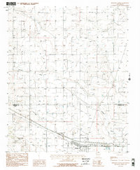
1986 Map of Moriarty North
USGS Topo · Published 1986About this map
The high plains of Central New Mexico are captured in the mid-1980s, centered on the growing settlement of Moriarty. The landscape is defined by the intersection of modern infrastructure and the remnants of earlier eras, most notably the Old Railroad Grade cutting across the southwestern quadrant. This era's development is evident in the cluster of features at the southern edge, including a Trailer Park, Substation, and Sewage Disposal Ponds, indicating the town's expansion. Natural drainage patterns across this arid basin are marked by the presence of Bachelor Draw and Salt Draw, which snake through the terrain toward the southern hub. Further north, the settlement of Otto sits along a grid of section lines and wells, while a small Landing Strip provides air access to this expansive ranching and agricultural region. Numerous Well markers and pipelines underscore the area's reliance on groundwater management during this period of New Mexico's history.
Find a feature on this map
14 named features on this map. Tap any name to fly to it.
Don’t see what you’re looking for? This feature index may not catch every label — zoom into the map to look around manually.
Map Details
Editions of this 1986 Moriarty North Map
2 editions found
Other maps of this area

1892 · San Pedro
USGS Topo · 1:125,000

1894 · Lamy
USGS Topo · 1:125,000

1917 · Estancia
USGS Topo · 1:125,000

1954 · Chilili
USGS Topo · 1:24,000

1954 · San Pedro
USGS Topo · 1:24,000

1954 · Edgewood
USGS Topo · 1:24,000

1954 · Santa Fe
USGS Topo · 1:250,000

1954 · Fort Sumner
USGS Topo · 1:250,000

1954 · Socorro
USGS Topo · 1:250,000

1956 · Edgewood
USGS Topo · 1:62,500