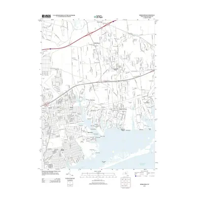
2013 Map of Moriches
USGS Topo · Published 2013About this map
The William Floyd Estate and the surrounding coastal reach of the Atlantic Ocean dominate this modern topographical record of Suffolk County. Along the shorelines of Narrow Bay and Moriches Inlet, the map details a complex network of coastal settlements from Mastic Beach to East Moriches. The interior landscape reveals a blend of legacy and recreation, featuring the New York National Speedway and the Long Island Game Farm alongside numerous burial grounds such as Brookfield Cem and Mt Pleasant Cem.
Find a feature on this map
67 named features on this map. Tap any name to fly to it.
Don’t see what you’re looking for? This feature index may not catch every label — zoom into the map to look around manually.
Map Details
Editions of this 2013 Moriches Map
This is the sole edition of this map. No revisions or reprints were ever made.
Other maps of this area

1903 · Riverhead
USGS Topo · 1:62,500

1904 · Riverhead
USGS Topo · 1:62,500

1904 · Moriches
USGS Topo · 1:62,500

1943 · Riverhead
USGS Topo · 1:62,500

1947 · Bellport
USGS Topo · 1:24,000

1947 · Howells Point
USGS Topo · 1:24,000

1947 · Riverhead
USGS Topo · 1:24,000

1947 · Eastport
USGS Topo · 1:24,000
1947 · Middle Island
USGS Topo · 1:24,000

1949 · New York
USGS Topo · 1:250,000