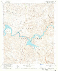
1964 Map of Mormon Flat Dam
USGS Topo · Published 1970About this map
Saguaro Lake dominates this mid-century survey, following the winding course of the Salt River through the heart of the Tonto National Forest. The engineering focal point is the Mormon Flat Dam, which maintains the reservoir's levels amidst a landscape of dramatic geological formations and arid drainage systems. The Apache Trail provides the primary transit artery through this territory, passing the small settlement of Tortilla Flat and the expansive Mesquite Flat to the east.
Find a feature on this map
45 named features on this map. Tap any name to fly to it.
Don’t see what you’re looking for? This feature index may not catch every label — zoom into the map to look around manually.
Map Details
Editions of this 1964 Mormon Flat Dam Map
4 editions found
Other maps of this area

1900 · Florence
USGS Topo · 1:125,000

1902 · Florence
USGS Topo · 1:125,000

1904 · Desert Well
USGS Topo · 1:62,500

1904 · Ft. McDowell
USGS Topo · 1:62,500

1906 · Ft. McDowell
USGS Topo · 1:62,500

1906 · Desert Well
USGS Topo · 1:62,500

1907 · Roosevelt
USGS Topo · 1:125,000

1909 · Four Peaks
USGS Topo · 1:125,000

1912 · Roosevelt
USGS Topo · 1:125,000

1930 · Cave Creek
USGS Topo · 1:125,000