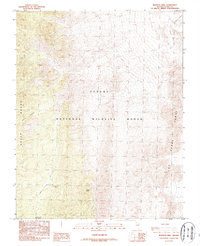
1987 Map of Mormon Well
USGS Topo · Published 1987About this map
Desert National Wildlife Range covers much of this high-altitude landscape in Clark County, where the high ridges of the Sheep Range and Las Vegas Range dominate the topography. This 1987 provisional survey provides a detailed look at the vital water sources and travel corridors used in this arid region. The namesake Mormon Well and the nearby Wamp Spring are crucial waypoints in an otherwise unforgiving environment, connected by the rugged Mormon Well Road. Evidence of traditional movement through the canyons is visible in the designated Pack Trail that traverses the northern reaches of the quadrangle. High-elevation features like the Elbow Range and Sawmill Canyon frame the central basin, while the Mormon Pass Picnic Area suggests the area's use for mid-century recreation and land management.
Find a feature on this map
13 named features on this map. Tap any name to fly to it.
Don’t see what you’re looking for? This feature index may not catch every label — zoom into the map to look around manually.
Map Details
Editions of this 1987 Mormon Well Map
This is the sole edition of this map. No revisions or reprints were ever made.
Other maps of this area

1886 · Saint Thomas
USGS Topo · 1:250,000

1893 · Saint Thomas
USGS Topo · 1:250,000

1907 · Las Vegas
USGS Topo · 1:250,000

1908 · Las Vegas
USGS Topo · 1:250,000

1945 · Sheep Range
USGS Topo · 1:125,000

1954 · Las Vegas
USGS Topo · 1:250,000

1957 · Las Vegas
USGS Topo · 1:250,000

1958 · Arrow Canyon
USGS Topo · 1:62,500

1959 · Las Vegas
USGS Topo · 1:250,000

1960 · Hayford Peak
USGS Topo · 1:62,500