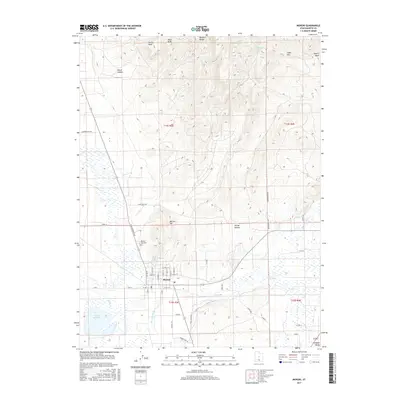
2017 Map of Moroni
USGS Topo · Published 2017About this map
The Sanpete Valley floor is anchored by the settlement of Moroni, where a structured grid of streets like N Center St and E 400 N St meets the winding course of the San Pitch River. This survey captures the town’s relationship with its immediate geography, bounded by the prominent Moroni Hill to the north and the expansive Wales Reservoir to the southwest. The landscape shifts abruptly from the irrigated valley floor to the high elevations of the Wasatch Range, marked by summits such as Devils Peak and Black Knob.
Find a feature on this map
51 named features on this map. Tap any name to fly to it.
Don’t see what you’re looking for? This feature index may not catch every label — zoom into the map to look around manually.
Map Details
Editions of this 2017 Moroni Map
This is the sole edition of this map. No revisions or reprints were ever made.
Other maps of this area

1885 · Manti
USGS Topo · 1:250,000

1895 · Manti
USGS Topo · 1:250,000

1951 · Moroni
USGS Topo · 1:62,500

1956 · Price
USGS Topo · 1:250,000

1960 · Price
USGS Topo · 1:250,000

1962 · Price
USGS Topo · 1:250,000

1965 · Wales
USGS Topo · 1:24,000

1966 · Spring City
USGS Topo · 1:24,000

1966 · Chester
USGS Topo · 1:24,000
1967 · Mount Pleasant
USGS Topo · 1:24,000