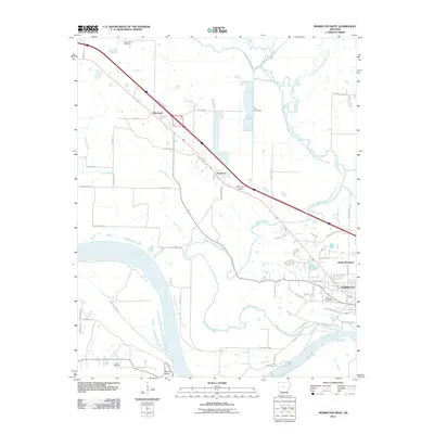
2011 Map of Morrilton West
USGS Topo · Published 2011About this map
The Arkansas River sweeps across the southwestern quadrant of this landscape, its northern bank defined by the sharp high ground of Stouts Point and the adjacent Camp Mitchell. The city of Morrilton anchors the southeastern corner, where a dense grid of streets like W Church St and W Batson Hill RD transitions into the outlying residential pockets of Spring Meadows. This era shows a community shaped by its waterways and transport corridors, with the Morrilton Airport and major roadways connecting the primary city to the smaller settlements of Kenwood and Blackwell to the northwest.
Find a feature on this map
56 named features on this map. Tap any name to fly to it.
Don’t see what you’re looking for? This feature index may not catch every label — zoom into the map to look around manually.
Map Details
Editions of this 2011 Morrilton West Map
This is the sole edition of this map. No revisions or reprints were ever made.
Other maps of this area

1889 · Morrilton No. 3
USGS Topo · 1:62,500

1892 · Morrillton
USGS Topo · 1:125,000

1894 · Morrillton
USGS Topo · 1:125,000

1956 · Russellville
USGS Topo · 1:250,000

1961 · Perryville
USGS Topo · 1:24,000

1961 · Morrilton East
USGS Topo · 1:24,000

1961 · Morrilton West
USGS Topo · 1:24,000

1961 · Houston
USGS Topo · 1:24,000

1961 · Adona
USGS Topo · 1:24,000

1961 · Atkins
USGS Topo · 1:24,000