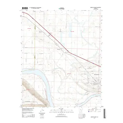
2014 Map of Morrilton West
USGS Topo · Published 2014About this map
Petit Jean Mtn rises sharply over the southern bank of the Arkansas River, anchoring a landscape where river bottomlands meet upland ridges. This 2014 survey captures the western extent of Morrilton, showing the city's growth toward Spring Meadows and the industrial infrastructure near Hydro Plant Rd. The geography is defined by the winding course of Point Remove Creek and its tributaries, such as Kuhn Bayou, which drain the low-lying Atkins Bottom Rd area.
Find a feature on this map
65 named features on this map. Tap any name to fly to it.
Don’t see what you’re looking for? This feature index may not catch every label — zoom into the map to look around manually.
Map Details
Editions of this 2014 Morrilton West Map
This is the sole edition of this map. No revisions or reprints were ever made.
Other maps of this area

1889 · Morrilton No. 3
USGS Topo · 1:62,500

1892 · Morrillton
USGS Topo · 1:125,000

1894 · Morrillton
USGS Topo · 1:125,000

1956 · Russellville
USGS Topo · 1:250,000

1961 · Perryville
USGS Topo · 1:24,000

1961 · Morrilton East
USGS Topo · 1:24,000

1961 · Morrilton West
USGS Topo · 1:24,000

1961 · Houston
USGS Topo · 1:24,000

1961 · Adona
USGS Topo · 1:24,000

1961 · Atkins
USGS Topo · 1:24,000