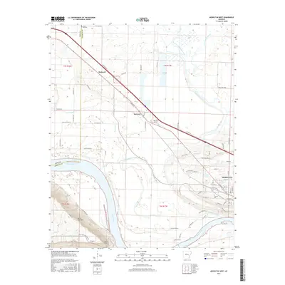
2017 Map of Morrilton West
USGS Topo · Published 2017About this map
The Arkansas River bends sharply past the prominent overlook of Petit Jean Mtn, anchoring a landscape where river navigation and historical overland routes meet. Near Stouts Point, the terrain rises dramatically from the riverbanks, overlooking the sprawling valley floor where Point-Remove Creek and its various forks converge. The western edge of Morrilton shows a developed grid including W Broadway St and Elmwood Cem, while the northern reaches transition into a network of drainage features like Kuhn Bayou and Fish Lake. Evidence of earlier transport persists in the naming of Old Wire Rd, running parallel to the modern corridor near Blackwell. Small clusters of activity at Kenwood and the Morrilton Airport highlight the mix of agricultural bottomlands and evolving local infrastructure in this Conway County corridor.
Find a feature on this map
76 named features on this map. Tap any name to fly to it.
Don’t see what you’re looking for? This feature index may not catch every label — zoom into the map to look around manually.
Map Details
Editions of this 2017 Morrilton West Map
This is the sole edition of this map. No revisions or reprints were ever made.
Other maps of this area

1889 · Morrilton No. 3
USGS Topo · 1:62,500

1892 · Morrillton
USGS Topo · 1:125,000

1894 · Morrillton
USGS Topo · 1:125,000

1956 · Russellville
USGS Topo · 1:250,000

1961 · Perryville
USGS Topo · 1:24,000

1961 · Morrilton East
USGS Topo · 1:24,000

1961 · Morrilton West
USGS Topo · 1:24,000

1961 · Houston
USGS Topo · 1:24,000

1961 · Adona
USGS Topo · 1:24,000

1961 · Atkins
USGS Topo · 1:24,000