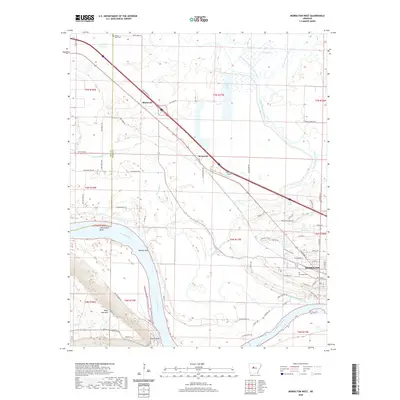
2020 Map of Morrilton West
USGS Topo · Published 2020About this map
Petit Jean Mtn dominates the southwestern portion of this Arkansas River valley landscape, overlooking a series of dramatic river curves including Linksweilers Bend and Dowdie Bend. The city of Morrilton serves as the primary population center on the eastern edge, showing a well-defined street grid and the Elmwood Cem near its western limits. Moving northwest, the settlements of Kenwood and Blackwell follow the corridor of Highway 64 and the interstate, tracing a path toward the Pope County line.
Find a feature on this map
72 named features on this map. Tap any name to fly to it.
Don’t see what you’re looking for? This feature index may not catch every label — zoom into the map to look around manually.
Map Details
Editions of this 2020 Morrilton West Map
This is the sole edition of this map. No revisions or reprints were ever made.
Other maps of this area

1889 · Morrilton No. 3
USGS Topo · 1:62,500

1892 · Morrillton
USGS Topo · 1:125,000

1894 · Morrillton
USGS Topo · 1:125,000

1956 · Russellville
USGS Topo · 1:250,000

1961 · Perryville
USGS Topo · 1:24,000

1961 · Morrilton East
USGS Topo · 1:24,000

1961 · Morrilton West
USGS Topo · 1:24,000

1961 · Houston
USGS Topo · 1:24,000

1961 · Adona
USGS Topo · 1:24,000

1961 · Atkins
USGS Topo · 1:24,000