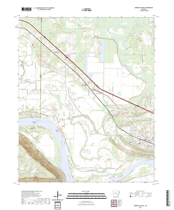
2024 Map of Morrilton West
USGS Topo · Published 2024About this map
The Arkansas River carves a dramatic path through this central Arkansas landscape, creating several prominent meanders including Linksweilers Bend, Dowdie Bend, and Happy Bend. The terrain is dominated by the northern face of Petit Jean Mountain, which rises sharply from the riverbank near Stouts Point. This area serves as a critical junction where the water-level topography of the river valley meets the elevated ridges of the Ozark foothills, reflected in the winding path of Monastery Ridge Rd.
Find a feature on this map
77 named features on this map. Tap any name to fly to it.
Don’t see what you’re looking for? This feature index may not catch every label — zoom into the map to look around manually.
Map Details
Editions of this 2024 Morrilton West Map
This is the sole edition of this map. No revisions or reprints were ever made.
Other maps of this area

1889 · Morrilton No. 3
USGS Topo · 1:62,500

1892 · Morrillton
USGS Topo · 1:125,000

1894 · Morrillton
USGS Topo · 1:125,000

1956 · Russellville
USGS Topo · 1:250,000

1961 · Perryville
USGS Topo · 1:24,000

1961 · Morrilton East
USGS Topo · 1:24,000

1961 · Morrilton West
USGS Topo · 1:24,000

1961 · Houston
USGS Topo · 1:24,000

1961 · Adona
USGS Topo · 1:24,000

1961 · Atkins
USGS Topo · 1:24,000