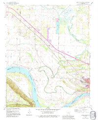
1991 Map of Morrilton West
USGS Topo · Published 1995About this map
Petit Jean Mountain rises dramatically above the south bank of the Arkansas River, creating a distinctive geographic barrier that shaped the development of Morrilton. The landscape is defined by the winding course of Point Remove Creek and its various branches, which separate the river lowlands from the growing industrial and residential zones. This era shows the expansion of the town near the Country Club and Oddfellows Cem, alongside infrastructure like Lock and Dam No 9 and a Fish Hatchery. Genealogy and local history are preserved in several family and community sites, including Happy Bend Cem and Hill Cem near the Blackwell settlement. To the west, the protected terrain of Petit Jean State Park at Stouts Point provides a clear view of the river's historic transport corridor.
Find a feature on this map
33 named features on this map. Tap any name to fly to it.
Don’t see what you’re looking for? This feature index may not catch every label — zoom into the map to look around manually.
Map Details
Editions of this 1991 Morrilton West Map
This is the sole edition of this map. No revisions or reprints were ever made.
Other maps of this area

1889 · Morrilton No. 3
USGS Topo · 1:62,500

1892 · Morrillton
USGS Topo · 1:125,000

1894 · Morrillton
USGS Topo · 1:125,000

1956 · Russellville
USGS Topo · 1:250,000

1961 · Perryville
USGS Topo · 1:24,000

1961 · Morrilton East
USGS Topo · 1:24,000

1961 · Morrilton West
USGS Topo · 1:24,000

1961 · Houston
USGS Topo · 1:24,000

1961 · Adona
USGS Topo · 1:24,000

1961 · Atkins
USGS Topo · 1:24,000