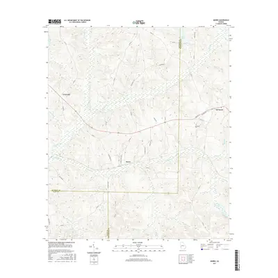
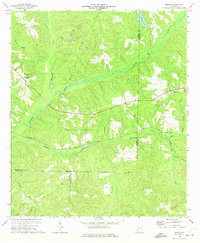
2017 Map of Morris
USGS Topo · Published 2017About this map
Morris sits at the center of this southwest Georgia landscape, positioned where Upper Morris Rd and Lower Morris Rd meet. The area is defined by a dense network of watercourses, with Pataula Creek and Holanna Creek meandering through the rural terrain of Quitman, Clay, and Randolph counties. This 2017 digital survey illustrates the enduring agricultural and residential patterns of the region, featuring small settlements like Crossroads and Springvale. Local genealogy is anchored by the Springvale Cem and family-named landmarks such as John Bennett Rd and Boyett Rd. Significant water features like Phillips Pond and numerous creeks, including Smitthee Jack Cr and Hodchodkee Cr, highlight the importance of local hydrology to the area's development and land use boundaries.
Find a feature on this map
50 named features on this map. Tap any name to fly to it.
Don’t see what you’re looking for? This feature index may not catch every label — zoom into the map to look around manually.
Map Details
Editions of this 2017 Morris Map
This is the sole edition of this map. No revisions or reprints were ever made.
Other maps of this area

1953 · Dothan
USGS Topo · 1:250,000

1954 · Dothan
USGS Topo · 1:250,000

1955 · Dothan
USGS Topo · 1:250,000

1967 · Hatcher
USGS Topo · 1:24,000

1967 · Georgetown
USGS Topo · 1:24,000

1969 · Fort Gaines NE
USGS Topo · 1:24,000
1972 · Sanford
USGS Topo · 1:24,000
1972 · County Line
USGS Topo · 1:24,000
1972 · Cuthbert
USGS Topo · 1:24,000
1973 · Morris
USGS Topo · 1:24,000