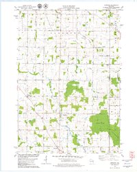
1978 Map of Morrison
USGS Topo · Published 1979About this map
The agricultural landscape of Glenmore and Morrison townships is defined by a dense network of country roads and small crossroads settlements in the late 1970s. This survey of southern Brown County reveals the traditional layout of Wisconsin dairy country, where towns like Morrison, Wayside, and Lark served as local hubs. The map is particularly useful for genealogists, as it identifies several rural institutions including St Mary Ch, Zion Cem, and Immanuel Sch. Low-lying areas like Morrison Swamp and Copperstown Swamp interrupt the surveyed grid, while the Devils River winds through the eastern portion of the quadrangle. Industrial activity is noted at the Quarry near Morrison and several gravel pits, showing the local extraction that supported the area's development. Public land is represented by the Way-Mor County Park, situated along the winding course of the Branch River.
Find a feature on this map
42 named features on this map. Tap any name to fly to it.
Don’t see what you’re looking for? This feature index may not catch every label — zoom into the map to look around manually.
Map Details
Editions of this 1978 Morrison Map
This is the sole edition of this map. No revisions or reprints were ever made.
Other maps of this area

1954 · De Pere
USGS Topo · 1:62,500

1954 · Denmark
USGS Topo · 1:62,500

1954 · De Pere
USGS Topo · 1:24,000

1954 · Chilton
USGS Topo · 1:62,500

1954 · Reedsville
USGS Topo · 1:62,500

1954 · Manitowoc
USGS Topo · 1:250,000

1954 · Bellevue
USGS Topo · 1:24,000

1955 · Green Bay
USGS Topo · 1:250,000

1958 · Manitowoc
USGS Topo · 1:250,000

1974 · Brillion
USGS Topo · 1:24,000