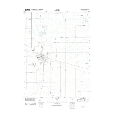
2012 Map of Morrison
USGS Topo · Published 2012About this map
Morrison serves as the hub of this Whiteside County landscape, where the confluence of several branches of Rock Cr and French Cr meets the local road network. The map illustrates a transition between the established city center and the agricultural reaches of the Illinois prairie. To the northwest, the Annan Grist Mill stands near Unionville, representing the area's milling history, while the small settlement of Malvern occupies the northeastern corner. The geography is shaped by water, notably Lake Carlton and the meandering creeks that drain the surrounding fields. Genealogists will find several burial grounds mapped in the rural sections, including Mennonite Cem, Malvern Cem, and Heaton Cem. The modern infrastructure is also represented by the Prairie Hill Recycling and Disposal Facility in the southeast, contrasting with the century-old landmarks elsewhere.
Find a feature on this map
56 named features on this map. Tap any name to fly to it.
Don’t see what you’re looking for? This feature index may not catch every label — zoom into the map to look around manually.
Map Details
Editions of this 2012 Morrison Map
This is the sole edition of this map. No revisions or reprints were ever made.
Other maps of this area

1891 · Clinton
USGS Topo · 1:62,500

1894 · Clinton
USGS Topo · 1:62,500

1899 · Clinton
USGS Topo · 1:125,000

1932 · Prophetstown
USGS Topo · 1:48,000

1934 · Morrison
USGS Topo · 1:48,000

1936 · Prophetstown
USGS Topo · 1:62,500

1940 · Morrison
USGS Topo · 1:62,500

1952 · Erie
USGS Topo · 1:62,500

1952 · Clinton
USGS Topo · 1:62,500

1958 · Davenport
USGS Topo · 1:250,000