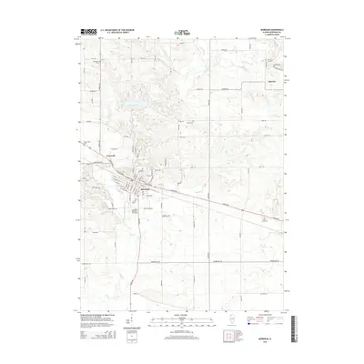
2015 Map of Morrison
USGS Topo · Published 2015About this map
Morrison serves as the central hub for this portion of Whiteside County, positioned at the intersection of significant local thoroughfares like W Lincolnway and Crosby Rd. The landscape is characterized by the winding path of Rock Cr, which feeds into the recreational area around Lake Carlton to the north. This survey documents the transition from the concentrated residential blocks of the city to the expansive agricultural grid that surrounds it, marked by small rural settlements like Malvern and Unionville. Local history is deeply etched into the land through a series of family and community burial grounds, including the Minnonite Cem and Grove Hill Cem. Educational foundations are represented by the Morrison Institute of Technology, while the names on the rural road network, such as Damen Rd and Holly Rd, hint at the long-standing agricultural lineages of the region.
Find a feature on this map
78 named features on this map. Tap any name to fly to it.
Don’t see what you’re looking for? This feature index may not catch every label — zoom into the map to look around manually.
Map Details
Editions of this 2015 Morrison Map
This is the sole edition of this map. No revisions or reprints were ever made.
Other maps of this area

1891 · Clinton
USGS Topo · 1:62,500

1894 · Clinton
USGS Topo · 1:62,500

1899 · Clinton
USGS Topo · 1:125,000

1932 · Prophetstown
USGS Topo · 1:48,000

1934 · Morrison
USGS Topo · 1:48,000

1936 · Prophetstown
USGS Topo · 1:62,500

1940 · Morrison
USGS Topo · 1:62,500

1952 · Erie
USGS Topo · 1:62,500

1952 · Clinton
USGS Topo · 1:62,500

1958 · Davenport
USGS Topo · 1:250,000