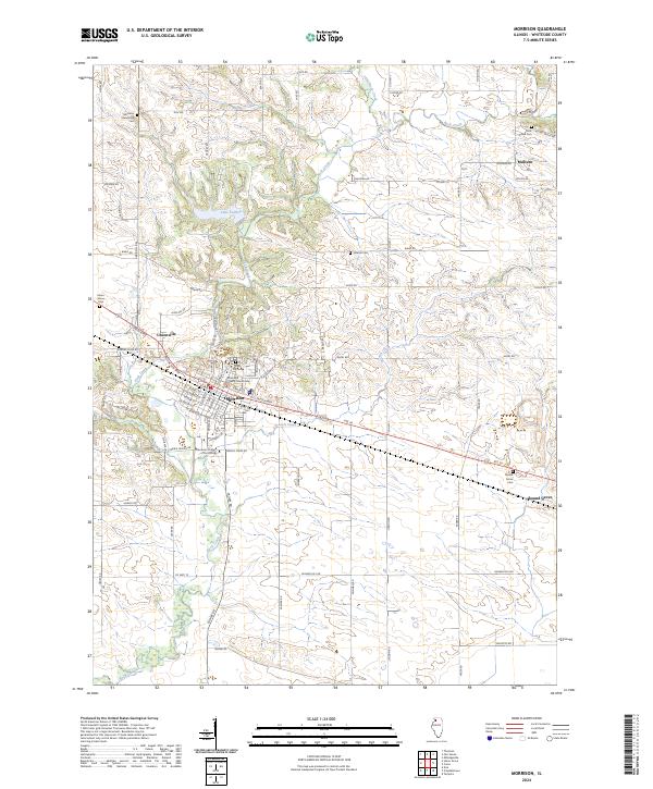
2024 Map of Morrison
USGS Topo · Published 2024About this map
Morrison serves as a significant administrative and educational hub in this portion of Whiteside County, anchored by the Whiteside County Courthouse and the Morrison Institute of Technology. The landscape is defined by the winding course of Rock Creek and the recreational waters of Lake Carlton to the north. Smaller settlements like Unionville, Malvern, and Round Grove are connected by a network of rural roads such as Bunker Hill Rd and Crosby Rd. For those tracing local history, several distinct burial grounds are documented, including the Morrison Mennonite Cem and the Grove Hill Cem. The map illustrates a settled agricultural region where residential pockets are interspersed with numerous smaller creeks like French Creek and Little Rock Creek.
Find a feature on this map
72 named features on this map. Tap any name to fly to it.
Don’t see what you’re looking for? This feature index may not catch every label — zoom into the map to look around manually.
Map Details
Editions of this 2024 Morrison Map
This is the sole edition of this map. No revisions or reprints were ever made.
Other maps of this area

1891 · Clinton
USGS Topo · 1:62,500

1894 · Clinton
USGS Topo · 1:62,500

1899 · Clinton
USGS Topo · 1:125,000

1932 · Prophetstown
USGS Topo · 1:48,000

1934 · Morrison
USGS Topo · 1:48,000

1936 · Prophetstown
USGS Topo · 1:62,500

1940 · Morrison
USGS Topo · 1:62,500

1952 · Erie
USGS Topo · 1:62,500

1952 · Clinton
USGS Topo · 1:62,500

1958 · Davenport
USGS Topo · 1:250,000