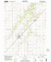
1998 Map of Morrisonville
USGS Topo · Published 2002About this map
The agrarian landscape of central Illinois is defined here by the intersection of rail and river across King, Bear Creek, and Ricks townships. Morrisonville serves as the primary hub, where the diagonal rail line creates a distinct grid orientation for the village center, situated just south of Trulock Lake. This survey reflects the persistence of late 20th-century rural infrastructure, where small cemeteries like St Maurice Cem and Morrisonville Cem are scattered among the vast drainage network of Prairie Fork and Bear Creek.
Find a feature on this map
18 named features on this map. Tap any name to fly to it.
Don’t see what you’re looking for? This feature index may not catch every label — zoom into the map to look around manually.
Map Details
Editions of this 1998 Morrisonville Map
This is the sole edition of this map. No revisions or reprints were ever made.
Other maps of this area

1922 · Divernon
USGS Topo · 1:62,500

1923 · Taylorville
USGS Topo · 1:62,500

1923 · Raymond
USGS Topo · 1:62,500

1924 · Divernon
USGS Topo · 1:62,500

1925 · Taylorville
USGS Topo · 1:62,500

1925 · Raymond
USGS Topo · 1:62,500

1946 · Nokomis
USGS Topo · 1:62,500

1949 · Nokomis
USGS Topo · 1:62,500

1958 · Decatur
USGS Topo · 1:250,000

1961 · Decatur
USGS Topo · 1:250,000