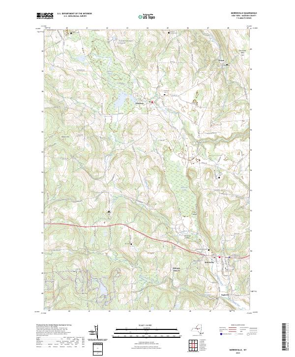
2023 Map of Morrisville
USGS Topo · Published 2023About this map
The village of Morrisville and the hamlet of Peterboro anchor this Madison County landscape, where the headwaters of the Chenango River and Oneida Creek carve through the rolling terrain. The area is characterized by significant wetlands, most notably the Peterboro Swamp and Morrisville Swamp, which dominate the low-lying drainage basins between the ridges. Education is a defining local feature, with the campus of SUNY Morrisville situated on the eastern edge of the village. The surrounding countryside is dotted with family-named landmarks like Mutton Hill and several small, scattered burial grounds including Peterboro Cem, Siloam Cem, and the Westcott Cem. This geography reveals a long-standing agricultural and institutional character, connected by a network of rural roads such as Swamp School Rd and Glass Factory Rd that hint at the region's earlier local industries.
Find a feature on this map
109 named features on this map. Tap any name to fly to it.
Don’t see what you’re looking for? This feature index may not catch every label — zoom into the map to look around manually.
Map Details
Editions of this 2023 Morrisville Map
This is the sole edition of this map. No revisions or reprints were ever made.
Other maps of this area

1895 · Chittenango
USGS Topo · 1:62,500

1895 · Oneida
USGS Topo · 1:62,500

1897 · Cazenovia
USGS Topo · 1:62,500

1898 · Oneida
USGS Topo · 1:62,500

1898 · Chittenango
USGS Topo · 1:62,500

1899 · Cazenovia
USGS Topo · 1:62,500

1902 · Chittenango
USGS Topo · 1:62,500

1902 · Morrisville
USGS Topo · 1:62,500

1902 · Oneida
USGS Topo · 1:62,500

1939 · Oneida
USGS Topo · 1:62,500