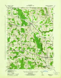
1944 Map of Morrisville
USGS Topo · Published 1944About this map
Morrisville serves as the focal point of this Madison County survey, anchored by the State Agricultural and Technical Institute and a network of arterial roads. The landscape is defined by significant wetlands, including the expansive Peterboro Swamp to the north and the Morrisville Swamp flanking the village. Historic travel routes like the Cherry Valley Turnpike and Peterboro Turnpike intersect the terrain, connecting a series of rural crossroads such as Bliss Corners, Hughes Corners, and Roberts Corners.
Find a feature on this map
45 named features on this map. Tap any name to fly to it.
Don’t see what you’re looking for? This feature index may not catch every label — zoom into the map to look around manually.
Map Details
Editions of this 1944 Morrisville Map
This is the sole edition of this map. No revisions or reprints were ever made.
Other maps of this area

1895 · Chittenango
USGS Topo · 1:62,500

1895 · Oneida
USGS Topo · 1:62,500

1897 · Cazenovia
USGS Topo · 1:62,500

1898 · Oneida
USGS Topo · 1:62,500

1898 · Chittenango
USGS Topo · 1:62,500

1899 · Cazenovia
USGS Topo · 1:62,500

1902 · Chittenango
USGS Topo · 1:62,500

1902 · Morrisville
USGS Topo · 1:62,500

1902 · Oneida
USGS Topo · 1:62,500

1939 · Oneida
USGS Topo · 1:62,500