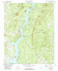
1981 Map of Morrow Mountain
USGS Topo · Published 1990About this map
Morrow Mountain State Park and the Uwharrie National Forest dominate this river-bound landscape, where the waters of the Pee Dee River and Lake Tillery separate Stanly and Montgomery Counties. The terrain is marked by the distinctive peaks of the Morrow Mountains, including Morrow Mtn and Sugarloaf Mtn, while the shoreline is dotted with mid-century residential developments and recreational access points. Local life is centered around rural landmarks like Stony Hill Ch and White Crest Ch, alongside several riverside communities such as Carolina Forest and Holiday Shores. A quarry near Horse Trough Mtn and the presence of numerous named creeks like Dutchmans Creek and Cattail Creek illustrate the intersection of natural resources and outdoor recreation during this era of North Carolina's development.
Find a feature on this map
55 named features on this map. Tap any name to fly to it.
Don’t see what you’re looking for? This feature index may not catch every label — zoom into the map to look around manually.
Map Details
Editions of this 1981 Morrow Mountain Map
3 editions found
Other maps of this area

1942 · Troy
USGS Topo · 1:125,000

1953 · Raleigh
USGS Topo · 1:250,000

1953 · Charlotte
USGS Topo · 1:250,000

1954 · Charlotte
USGS Topo · 1:250,000

1954 · Raleigh
USGS Topo · 1:250,000

1956 · Mount Gilead East
USGS Topo · 1:24,000

1956 · Mount Gilead West
USGS Topo · 1:24,000

1957 · Albemarle
USGS Topo · 1:62,500

1957 · Troy
USGS Topo · 1:62,500

1960 · Charlotte
USGS Topo · 1:250,000