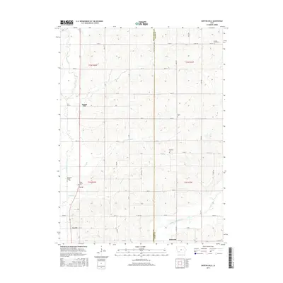
2015 Map of Morton Mills
USGS Topo · Published 2015About this map
The West Nodaway River and Middle Nodaway River carve through the agricultural landscape of Montgomery and Adams Counties, defining the drainage patterns for this section of southwest Iowa. The map documents several small historical nodes including Morton Mills, Sciola, Tenville, and Dickieville, which are linked by a grid of rural routes such as Co HWY h34 and Co RD g31. For genealogists, the map is particularly valuable for its documentation of family and community resting places. These include the Bolt Family Burying Ground near the western edge and several well-established sites like Lincoln Center Cem, Strand Cem, and Thompson Cem. The presence of the Sciola Baptist Cem adjacent to the settlement of Sciola indicates the local importance of early religious and social centers. The terrain is marked by numerous small tributaries like Sin Cr, Longs Br, and Fultons Cr that cut through the rolling farm country.
Find a feature on this map
53 named features on this map. Tap any name to fly to it.
Don’t see what you’re looking for? This feature index may not catch every label — zoom into the map to look around manually.
Map Details
Editions of this 2015 Morton Mills Map
This is the sole edition of this map. No revisions or reprints were ever made.
Other maps of this area

1954 · Omaha
USGS Topo · 1:250,000

1955 · Nebraska City
USGS Topo · 1:250,000

1957 · Nebraska City
USGS Topo · 1:250,000

1957 · Omaha
USGS Topo · 1:250,000

1958 · Omaha
USGS Topo · 1:250,000

1958 · Nebraska City
USGS Topo · 1:250,000

1978 · Stanton
USGS Topo · 1:24,000

1978 · Wallin
USGS Topo · 1:24,000

1978 · Griswold NE
USGS Topo · 1:24,000

1980 · Grant
USGS Topo · 1:24,000